In this field note18 sections +Close −
- 01Weather, climate and glacier behaviour are different
- 02The Karakoram anomaly is not immunity
- 03What local expedition teams notice
- 04Hazards linked to changing ice and water
- 05From snowfall to rivers: the connected system
- 06Agriculture, drinking water and village life
- 07Floods, landslides and the roads that connect valleys
- 08Tourism, trekking routes and climbing conditions
- 09Porter livelihoods and climate exposure
- 10Wildlife, vegetation and waste under pressure
- 11What local observations can—and cannot—tell us
- 12Future risks and responsible choices
- 13How expedition planning should adapt
- 14What travellers can do without making false claims
- 15Reading conditions in the field
- 16Climate-aware expedition checklist
- 17Internal planning links
- 18Frequently asked questions
Climate change in the Karakoram is easy to oversimplify. One headline says the glaciers are stable; another says the ice is disappearing. A trekker then reaches the Baltoro, sees an immense glacier and reasonably asks which account is true.
The careful answer is that the Karakoram is not one glacier and a single season is not a climate record. Glaciers differ by elevation, aspect, debris cover, snowfall source, avalanche input and whether they surge. Scientific measurements also cover different periods. The regional picture is complex, but continued warming, changing snow and rainfall, and evolving glacier hazards are not reasons for complacency.
From our side in Skardu and Askole, climate change is not an abstract debate. It enters route planning through damaged roads, unusual heat, changing river crossings, unstable moraine, uncertain snow bridges and water availability. A guide’s observation is valuable for today’s route; long-term research is necessary for climate conclusions. We need both.
Field principle: Never use one hot afternoon, one advancing glacier tongue or one dramatic photograph as proof of a long-term trend. Record the observation, then place it in the larger evidence.
Weather, climate and glacier behaviour are different
Weather is what the team encounters this hour or week. Climate describes patterns over decades. Glacier mass balance is the difference between accumulation—mainly snow—and losses through melt, sublimation and ice discharge over a period. Glacier length or a moving terminus does not alone reveal that full balance.
Observation | What it may indicate | What it does not prove by itself |
|---|---|---|
A hot trekking week | Immediate heat stress and stronger melt | A regional climate trend |
An advancing glacier front | Faster ice flow or a surge | Long-term mass gain |
More exposed moraine | Local surface lowering or route change | The rate for every Karakoram glacier |
A new lake | Changing drainage or ice conditions | That an outburst is imminent |
Late snow on a pass | Current seasonal conditions | Reliable snow in future years |
This distinction matters for safety. We act on immediate observations even when they cannot establish a climate trend. A swollen stream still requires a route change. A weak snow bridge is unsafe regardless of the cause.
The Karakoram anomaly is not immunity
Research found that parts of the Karakoram had relatively stable or slightly positive glacier mass balances during periods when many other High Mountain Asia glaciers were losing mass. This became known as the “Karakoram anomaly.” Proposed influences include winter snowfall delivered by western weather systems, local temperature patterns, glacier geometry and thick debris cover.
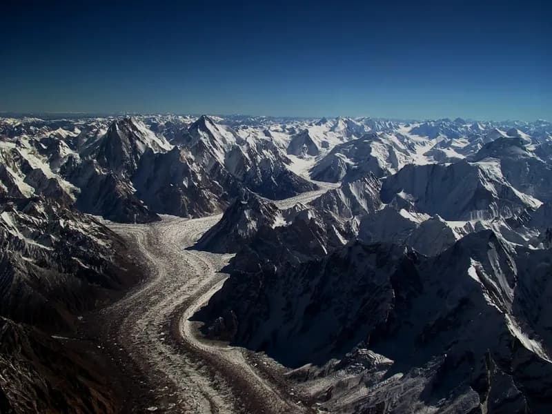
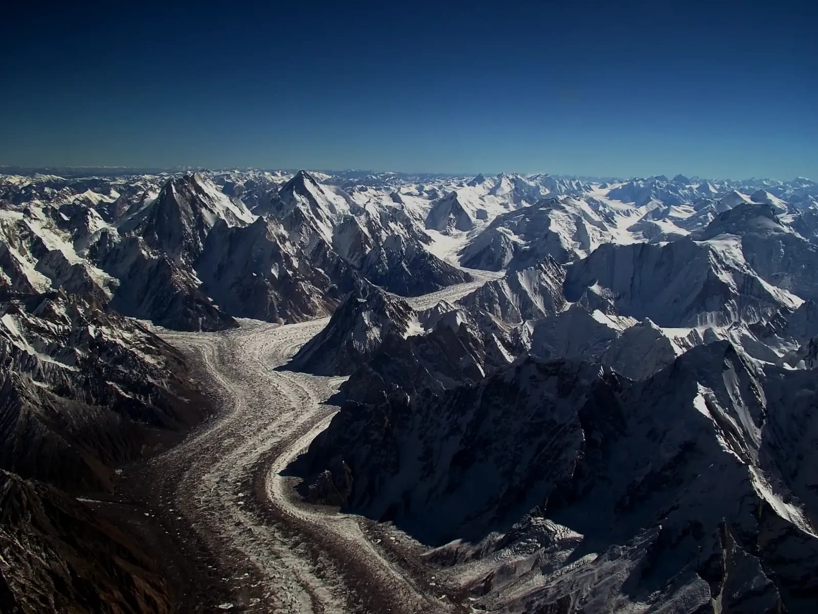
{{image:Baltoro_glacier_from_air-1.webp|Debris-covered Baltoro Glacier seen from above in the central Karakoram|Debris, ice, snow accumulation and local topography make neighbouring Karakoram glaciers respond differently.}}
The anomaly never meant that all Karakoram glaciers were growing, that conditions were permanent or that the range was protected from human-caused warming. The IPCC assessment of the Hindu Kush Himalaya notes limited evidence that the anomaly will persist and considers its long-term continuation unlikely under continued warming. Recent research continues to show strong differences between glaciers and time periods.
Debris cover adds another complication. A thin dark layer can increase absorption and melt, while thick debris can insulate ice. Ice cliffs and melt ponds create local hot spots. The Baltoro can therefore look like a field of rock while active ice lies beneath it.
What local expedition teams notice
We do not present operational observations as a substitute for a weather station or satellite record. They do, however, reveal how environmental change reaches travel.
Access roads and river valleys
The journey from Skardu toward Shigar and Askole follows steep valleys shaped by rivers, erosion and landslides. Intense rain, rapid snowmelt or flood damage can cut a road, move a river channel or require vehicles to stop at a different point. A published driving time is never a guarantee.
Moraine and glacier routes
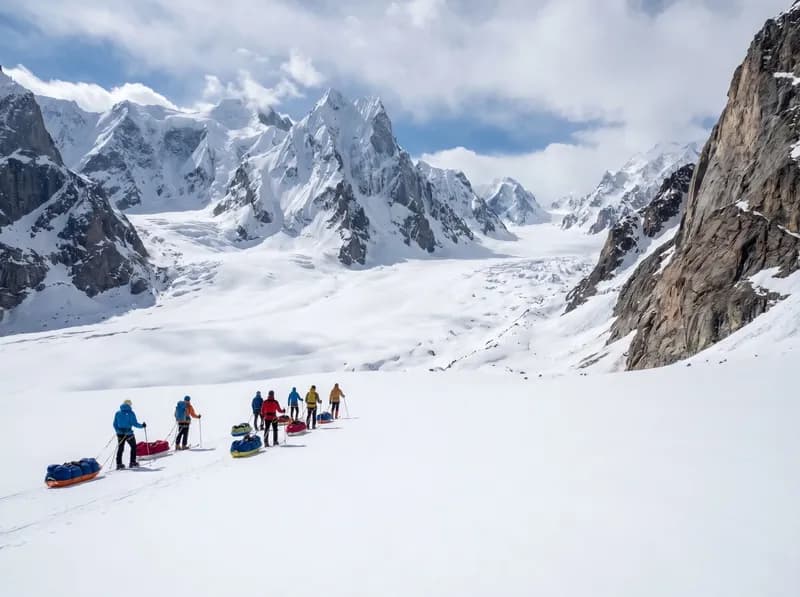
Glacier surfaces move continuously. Melt exposes ice, undermines debris and changes gullies. A line used last season may be inefficient or unsafe this year. Guides scout locally, listen to teams ahead and select a route for the present surface rather than following a historic GPS track blindly.
Snow bridges and crevasses
Snow cover can hide crevasses early in a season and weaken rapidly in heat. On Biafo, Hispar, Snow Lake and technical passes, timing and rope systems must reflect the actual surface. A white glacier is not automatically safer than a debris-covered one.
Water and camp comfort
Hot periods increase fluid needs and may make afternoon streams more difficult, while cold snaps can freeze small sources. Sediment loads change. Camps need flexible collection and treatment plans instead of assuming water will be identical at the same spot every year.
Hazards linked to changing ice and water
Glacial lakes can form or expand as ice retreats or drainage changes. Ice-dammed lakes can also develop around surging glaciers. A glacial lake outburst flood, or GLOF, occurs when stored water is released suddenly. Not every lake is dangerous, and visual size alone is not a risk assessment.
An ICIMOD review of GLOFs in the Himalaya–Karakoram region documents hundreds of historical events and emphasises the need for better monitoring, local observation and warning systems. For travellers, the practical response is to respect closures, avoid informal camps on exposed floodplains and take local reports seriously.
Other hazards can also change:
- Rockfall may increase during heat as ice that binds fractured rock weakens.
- Meltwater can undermine moraine, footpaths and road edges.
- Rain falling where snow was expected can raise runoff quickly.
- Wild temperature swings can create crust, wet-snow avalanche or icefall conditions.
- Surging glaciers can block valleys, alter drainage and create short-lived lakes.
Climate change does not make every accident predictable. It can alter the baseline on which historical route knowledge was built, making current field assessment even more important.
From snowfall to rivers: the connected system
Snowfall is the first link between climate, glaciers and life downstream. High-elevation winter and spring snow stores water, feeds glacier accumulation and influences when rivers rise. A winter with less snow, a warm spring that releases it quickly, or rain falling where snow was expected can each produce a different problem. The important question is not simply whether there is more or less water over a whole year, but whether it arrives when fields, households and expedition routes can use it safely.
Glaciers also store and release water on longer timescales. They are not static reservoirs: flow, melt, snowfall and debris interact. In the central Karakoram, neighbouring glaciers can behave differently, so a regional headline cannot replace observation of a particular valley. The ICIMOD work on water security in Gilgit-Baltistan describes how disrupted glacier-fed irrigation channels already affect farming communities even where ice remains visually extensive.
Agriculture, drinking water and village life
Many settlements in Gilgit-Baltistan move water through gravity-fed channels locally known as khuls. These channels can be cut into steep ground, cross unstable slopes and depend on an intake remaining connected to a stream or glacier. Floods can destroy them in hours. A lowering glacier surface can leave an older intake too high. Sediment can block a channel, while low flow can force households to ration water between drinking, livestock and crops.
That makes climate change a daily labour issue. Repairing a channel, clearing sediment and rebuilding a wall take time that would otherwise go to planting, harvesting, schooling or paid work. When water timing changes, families may change crops, reduce cultivated ground or seek income elsewhere. The effects are not evenly shared: households with less land, fewer working adults or limited cash have less room to absorb a damaged harvest or blocked road.
In Askole and other remote villages, the year has always required preparation. Food, fodder, fuel and household supplies are stored for cold months. Changing weather adds uncertainty to those established routines. It does not erase local resilience, but it can demand more work from communities that already live with short growing seasons and expensive access.
Floods, landslides and the roads that connect valleys
Glacial lake outburst floods are only one part of the hazard picture. Intense rain, rapid melt, river erosion, debris flows and landslides can damage homes, bridges, irrigation systems and the few roads joining remote valleys to markets and health services. A road closure that looks like an itinerary delay to a visitor can mean missed medical care, interrupted food supply or lost income for a village.
The road from Skardu through Shigar and the Braldu Valley illustrates this connection. Expedition access, resident travel and local trade share the same exposed corridor. Responsible operators keep schedule flexibility, receive road reports from the valley and refuse pressure to force an unsafe crossing merely to protect a printed itinerary.
Community knowledge and formal monitoring should support each other. Early-warning equipment, evacuation plans and mapped safe areas can save lives, while residents provide observations that distant instruments may not capture. The UNDP GLOF-II programme combines warning systems, irrigation work, slope stabilisation and community disaster planning across vulnerable northern valleys.
Tourism, trekking routes and climbing conditions
Tourism depends on the same roads, water and labour as village life. A season disrupted by flood, unusual heat or unsafe glacier conditions can reduce work for guides, cooks, drivers, hotel staff, animal owners and porters. Families may lose income even when an expedition itself is cancelled safely. Climate adaptation in tourism therefore includes fair cancellation terms, transparent staffing and avoiding last-minute transfer of all financial risk to local workers.
On the trail, warmer periods can increase heat stress on the dry approach, soften snow bridges earlier in the day and strengthen afternoon meltwater. Heavy rain can destabilise slopes and raise streams. Fresh snow can hide crevasses or load avalanche terrain. Climbing routes can see more rockfall when snow and ice no longer hold fractured rock in the same way, but the effect varies by face, elevation, season and short-term weather.
The practical response is not to promise a new fixed season. It is to retain acclimatisation and contingency time, compare current conditions with route history, scout where necessary and give guides the authority to change a camp, line, crossing time or objective. An old GPS track records where someone went; it does not certify the ground beneath it today.
Porter livelihoods and climate exposure
Porters experience environmental change as workers. Greater heat, longer detours around broken moraine, damaged bridges and unstable camp ground can add effort to a day that was priced and provisioned for older assumptions. If an access road ends early, more cargo may have to move on foot. If a group is delayed, staff need food, shelter and pay for the additional days.
Climate-aware operation must therefore include labour planning: controlled loads, suitable clothing and footwear, insurance for the assigned role, additional food and fuel for contingencies, and clear payment when weather extends or cancels work. It is not responsible to place every new environmental cost on the people carrying the expedition.
Wildlife, vegetation and waste under pressure
Changing water, temperature and snow conditions affect alpine plants, grazing and wildlife habitat, although the response differs across elevations and species. Tourism adds another pressure if camps expand, food waste attracts animals or plastic and human waste remain in cold environments where breakdown is slow.
Heat and flood disruption can also make waste handling harder. A damaged trail does not make rubbish disappear; it makes planned storage and carry-out capacity more important. Operators should minimise packaging in Skardu, separate waste, protect it from wind and animals, carry non-biodegradable material back, manage toilet sites away from water and record what leaves the route. Visitors should carry batteries, wipes and hygiene products out rather than hiding them under stones or in toilet pits.
What local observations can—and cannot—tell us
Residents, drivers, farmers, porters and guides notice dates of snowfall, channel flow, stream crossings, road failures, glacier surface changes and wildlife encounters. These observations are essential operational evidence and can become valuable climate records when they are dated, located and repeated consistently.
They should not be romanticised as infallible or used without consent. A single memory cannot calculate glacier mass balance, just as a satellite image cannot explain every effect on a household. The strongest picture combines local records, weather stations, remote sensing, hydrology and open discussion with the people affected.
Future risks and responsible choices
The future is unlikely to be a simple steady decline. Gilgit-Baltistan may face overlapping extremes: periods of water shortage, sudden destructive flows, hotter trekking days, heavy snowfall events, road isolation and changing disease or crop pressures. Uncertainty is not a reason to wait. It is a reason to protect options.
Public investment in safer roads, water systems, warning networks and health access matters far more than a visitor slogan. Tourism still has direct responsibilities. Operators can employ and train locally, budget for disruption, share credible hazard observations, reduce fuel and waste, avoid building in exposed places and communicate uncertainty honestly. Visitors can travel in smaller groups, accept conservative decisions, spend with locally owned services and avoid turning damaged communities into disaster photography.
The Karakoram is not an empty backdrop to a climate story. Snow, ice, rivers, farms, roads, wildlife, villages and expeditions are one connected mountain system. Responsible travel begins by seeing—and planning for—that connection.
How expedition planning should adapt
Build time into the itinerary
A tight international connection after a domestic mountain flight or long road exit transfers environmental uncertainty directly to the traveller. Keep contingency days before and after a remote journey. They are not wasted if unused; they protect the whole plan.
Use seasonal knowledge, then verify current conditions
Historical operating windows remain useful, but departure decisions must include recent snowfall, heat, road reports, river levels and reconnaissance. “We crossed here in 2019” is background, not a current hazard assessment.
Carry systems, not single solutions
A water filter can clog with glacial sediment. Solar charging can fail during cloud. A helicopter can be grounded. Teams need backups: settlement, chemical treatment or boiling as appropriate; protected battery reserves; radios and satellite communications; and a ground evacuation plan.
Report observations consistently
Guides can record dates, GPS locations, photographs from repeat viewpoints, stream conditions and route deviations. Consistent records are more useful than vague statements that a glacier “looked different.” Operators should share significant hazards with other teams and authorities.
What travellers can do without making false claims
- Choose an itinerary with realistic acclimatisation and contingency time.
- Use durable equipment and repair it instead of abandoning damaged items.
- Keep baggage within the limit so extra transport is not recruited unnecessarily.
- Minimise packaging and carry non-biodegradable waste out.
- Use group transport efficiently between Islamabad, Skardu and the roadhead.
- Respect closures, route changes and conservative decisions.
- Support credible glacier research or local resilience work after checking how funds are used.
- Avoid claiming that one carbon payment makes an expedition “climate neutral.”
The largest climate decisions are systemic, not personal. Still, direct operational reductions and honest communication are better than decorative green language.
Reading conditions in the field
Trekkers should not attempt to replace a guide’s assessment, but they can become better observers. Note recent overnight temperature, cloud build-up, stream colour and volume, fresh debris, cracking or collapsing sounds, and changes in snow firmness. Share observations calmly with the guide.
On hot glacier days, an early start may reduce heat exposure and improve snow strength, but timing also depends on camp routine and the terrain ahead. During rain, avoid lingering below loose slopes or in narrow drainage channels. Never approach a glacier lake outlet, ice cliff or active collapse zone for a photograph.
Climate-aware expedition checklist
Before booking
- Ask how contingency days and route changes are handled.
- Check whether the operator receives current road and glacier reports.
- Review waste, fuel and staff policies.
- Buy insurance that covers delays, route altitude, rescue and the planned activity.
Before leaving Skardu
- Review recent access, weather and stream conditions.
- Waterproof sleeping equipment, electronics and documents.
- Carry treatment backup and sufficient water capacity.
- Keep spare power and critical contacts offline.
During the journey
- Follow new route markings and guide instructions rather than old tracks.
- Report unusual water, ice or slope activity.
- Accept turnaround decisions without pressuring staff.
- Keep waste controlled during strong wind or flood disruption.
Internal planning links
See how glacier terrain affects the K2 Base Camp Trek, Snow Lake and Hispar La Trek and Biafo Glacier Trek. For related operations guidance, read life on the Baltoro, responsible trekking in Gilgit-Baltistan and travel insurance and helicopter rescue.
Frequently asked questions
Are Karakoram glaciers growing despite climate change?
Some glaciers showed stable or positive mass balance during certain study periods, and some surge or advance because their flow accelerates. The range is highly variable. This does not mean every glacier is growing or that the Karakoram is protected from continued warming.
What is the Karakoram anomaly?
It is the term used for the comparatively stable or slightly positive mass balance observed in parts of the Karakoram during periods when many neighbouring regions lost more ice. Its causes and duration remain active research topics.
Is the Baltoro Glacier retreating?
Different measurements describe different parts and periods of a complex glacier. Avoid judging total mass balance from the position or appearance of one section. Long-term remote sensing and field measurements provide the proper evidence.
Does climate change make trekking season shorter?
It can change snow, heat, rainfall, water and route stability, but there is no single fixed effect across every valley. Operators still use seasonal windows and then adjust to current access and field conditions.
Are glacier lake outburst floods predictable?
Monitoring can identify hazardous lakes and changing conditions, but the timing of a failure can remain uncertain. Travellers should follow official warnings, avoid exposed drainage areas and rely on local route decisions.
How should I photograph glacier change responsibly?
Use repeat viewpoints and record date and location if the image is intended as evidence. Do not enter collapse zones, approach unstable ice cliffs or present one photograph as proof of a regional trend.
End of field note
Continue your research.
Browse all notes