TrekkingAskole Region

Biafo Glacier Trek

Walk the 62 km Biafo Glacier from Askole to Snow Lake and back — a pure Karakoram glacier journey through one of the world's most remote high-altitude landscapes.

Askole Region — 4,800 m

Karakoram · Pakistan
Duration
20 days
Max Altitude
4,800 m
Difficulty
Hard
Group Size
6 – 12 people
Season
Summer
Journey Code
NE_BGT

Adventure Overview

The Biafo Glacier — End to End

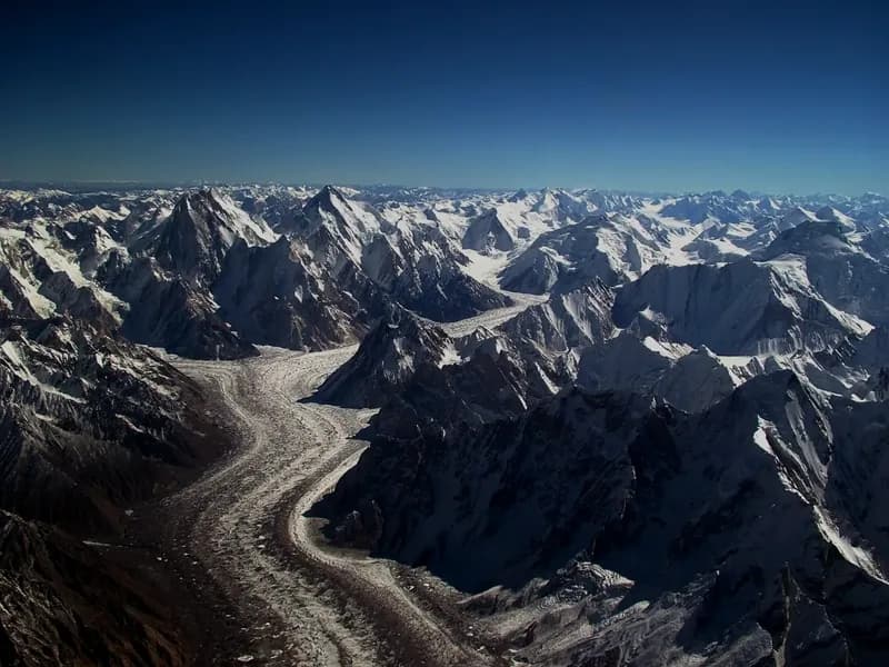
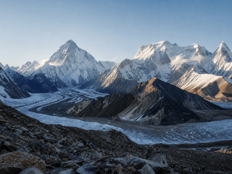
The Biafo Glacier Trek follows one of the longest glaciers outside the polar regions from its snout at Askole to the vast sub-polar snowfield of Lukpe Lawo — Snow Lake — and returns the same way. At 62 kilometres one-way, the Biafo is one of the world's great glacier systems. The trek is a pure glacier experience: no high-pass crossing, no technical terrain, but 12 consecutive days of travel through an extraordinary mountain world.

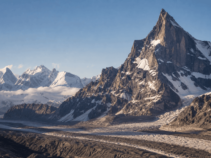
The route passes directly below Baintha Brakk — The Ogre (7,285 m) — and approaches the Latok group, ending on a snowfield so vast and featureless that it challenges the eye to find scale. There is no comparable trek in Pakistan for raw glacial landscape.

A Committing Wilderness Journey

Between Askole and Snow Lake there are no roads, no villages, and no infrastructure of any kind. The Biafo Glacier surface is not a trail — it is broken ice, moraine rubble, and meltwater channels, constantly shifting. No crampon technique is required for this route, but strong trekking fitness and a tolerance for sustained effort at altitude are non-negotiable.

The Biafo Glacier Trek is the ideal choice for trekkers who want genuine Karakoram wilderness without the technical demands of a high-pass crossing. It is also the natural first step before attempting the full Biafo–Hispar traverse via the Hispar La.

Suitable For

Who This Trip Is For

The Biafo Glacier Trek suits experienced trekkers who want genuine Karakoram wilderness without the technical demands of a high-pass crossing. Crampon experience is not required, but the ability to sustain 5–7 hours of physical effort per day at altitude for 12 consecutive trekking days is essential.

This is an excellent entry point to the region's most remote glacier terrain. If you have already completed the K2 Base Camp Trek or Gondogoro La and want to go further into the Karakoram glacier systems, the Biafo is the natural next step — and the Snow Lake & Hispar La traverse the one after.

Departures & Pricing

Plan Your Departure

Expedition Price

On request

Pricing depends on group size, route support, permits, and preferred departure window.

Listed Dates

Flex

Seats Open

Ask

Departure Dates

Plan a custom departure

Departure Window

Flexible

Flexible dates by request

Share your preferred arrival window and our team will confirm route timing, permits, and local crew availability.

Custom departure windows are confirmed with route timing, permits, and crew availability.

Itinerary

Day-by-Day Route Plan

Route Span

Days 1-20

Opening Stage

Day 1: Arrive Islamabad

Final Stage

Day 20: Departure

  1. Day01Arrive IslamabadDaily route segment

    Arrive at Islamabad International Airport. Transfer to hotel. Evening team briefing: route overview, gear check, permit documentation, and introduction to your guide team. Overnight Islamabad.

    After immigration and baggage collection, a Namla Expeditions representative meets the group in the arrivals area and coordinates the hotel transfer. At check-in, the team confirms delayed baggage, emergency contacts, insurance details, dietary information already supplied, and the next morning’s schedule. The first full briefing introduces the Biafo Glacier Trek route, transport and weather contingencies, luggage separation, communications, and outstanding equipment questions. The remainder of the day is intentionally unstructured for rest, hydration, and recovery after international travel.

  2. Day02Islamabad to SkarduDaily route segment

    Fly to Skardu (1 hour) or drive the Karakoram Highway (approximately 20 hours by road; not recommended as a single day). Flights are subject to mountain weather and may be delayed. Final equipment checks and porter briefings in Skardu. Overnight Skardu hotel.

    The operations team checks the latest airline and weather information before leaving the hotel and coordinates the airport transfer, tickets, and expedition baggage. Mountain flights remain weather-dependent; if a cancellation occurs, Namla Expeditions explains the available road contingency and revises later stages without compressing essential acclimatisation or safety time. After landing, the group collects all luggage before transferring to the hotel. A short arrival briefing covers meals, local timing, equipment access, and the next day’s plan.

  3. Day03Skardu to AskoleDaily route segment3,040 m

    Drive from Skardu to Askole by 4WD jeep along the Braldu Valley road. Approximately 7–8 hours on a rough, unpaved road through the villages of Shigar, Chokpo, and Dasso. Askole (3,040 m) is the last settlement before the glacier. Overnight in Askole (guesthouse or camp).

    The group leaves after breakfast with personal bags and expedition loads secured in the assigned vehicles. Namla Expeditions drivers and field staff assess road, river, traffic, and weather conditions throughout the journey; stops are made for permits, meals, photography, and comfort only where parking is safe. Travel time can change after landslides or road works, so the day remains flexible. On arrival, rooms or tents are allocated, luggage is checked, and the guide gives a short briefing before dinner and rest.

  4. Day04Askole to KorophonDaily route segment3,100 m

    Trek begins. Follow the right bank of the Braldu River through terraced fields and into the canyon above Askole. Suspension bridge crossings over the Braldu. Camp at Korophon (3,100 m). Walking time: 3–4 hours.

    After breakfast, the camp crew packs the shared equipment and the porter team receives the day’s allocated loads while participants carry their personal daypacks. The lead guide sets a sustainable pace over the terrain described above, with planned stops for water, food, layer changes, and regrouping before exposed, loose, or glaciated sections. On reaching camp, the team checks in with the guide, changes into dry layers, hydrates, and inspects feet and equipment. Dinner is followed by a weather, health, and route briefing for the next stage.

  5. Day05Korophon to JoulaDaily route segment3,200 m

    Continue up the Braldu Valley along moraine terraces. A second suspension bridge crossing near Joula. The valley narrows as you approach the Biafo snout. Camp at Joula (3,200 m). Walking time: 5–6 hours.

    After breakfast, the camp crew packs the shared equipment and the porter team receives the day’s allocated loads while participants carry their personal daypacks. The lead guide sets a sustainable pace over the terrain described above, with planned stops for water, food, layer changes, and regrouping before exposed, loose, or glaciated sections. On reaching camp, the team checks in with the guide, changes into dry layers, hydrates, and inspects feet and equipment. Dinner is followed by a weather, health, and route briefing for the next stage.

  6. Day06Joula to BainthaDaily route segment3,750 m

    Climb onto the lateral moraine then onto the Biafo Glacier. Baintha (3,750 m) is the last grassy campsite — the final green before twelve days of ice. Walking time: 6–7 hours.

    After breakfast, the camp crew packs the shared equipment and the porter team receives the day’s allocated loads while participants carry their personal daypacks. The lead guide sets a sustainable pace over the terrain described above, with planned stops for water, food, layer changes, and regrouping before exposed, loose, or glaciated sections. On reaching camp, the team checks in with the guide, changes into dry layers, hydrates, and inspects feet and equipment. Dinner is followed by a weather, health, and route briefing for the next stage.

  7. Day07Baintha to MangoDaily route segment4,200 m

    First full glacier travel day. The Biafo surface is broken moraine, meltwater channels, and ice formations. Navigation follows the right bank margin where the footing is steadiest. Camp at Mango (4,200 m). Walking time: 5–6 hours.

    After breakfast, the camp crew packs the shared equipment and the porter team receives the day’s allocated loads while participants carry their personal daypacks. The lead guide sets a sustainable pace over the terrain described above, with planned stops for water, food, layer changes, and regrouping before exposed, loose, or glaciated sections. On reaching camp, the team checks in with the guide, changes into dry layers, hydrates, and inspects feet and equipment. Dinner is followed by a weather, health, and route briefing for the next stage.

  8. Day08Mango to Snake CampDaily route segment7,285 m

    Continue up the Biafo. The glacier narrows and peaks grow in stature. Baintha Brakk — The Ogre (7,285 m) — dominates the skyline to the north. Camp at Snake Camp (4,380 m). Walking time: 5 hours.

    After breakfast, the camp crew packs the shared equipment and the porter team receives the day’s allocated loads while participants carry their personal daypacks. The lead guide sets a sustainable pace over the terrain described above, with planned stops for water, food, layer changes, and regrouping before exposed, loose, or glaciated sections. On reaching camp, the team checks in with the guide, changes into dry layers, hydrates, and inspects feet and equipment. Dinner is followed by a weather, health, and route briefing for the next stage.

  9. Day09Snake Camp to Upper BiafoDaily route segment4,550 m

    Approach the wide upper basin where the Sim Gang Glacier joins the Biafo from the north. The landscape opens dramatically. Camp at Upper Biafo (4,550 m). Walking time: 5–6 hours.

    After breakfast, the camp crew packs the shared equipment and the porter team receives the day’s allocated loads while participants carry their personal daypacks. The lead guide sets a sustainable pace over the terrain described above, with planned stops for water, food, layer changes, and regrouping before exposed, loose, or glaciated sections. On reaching camp, the team checks in with the guide, changes into dry layers, hydrates, and inspects feet and equipment. Dinner is followed by a weather, health, and route briefing for the next stage.

  10. Day10Acclimatisation — Upper BiafoDaily route segment4,550 m

    Rest and acclimatisation day at Upper Biafo (4,550 m). An essential physiological adjustment before ascending to Snow Lake at 4,800 m. Views of The Ogre (7,285 m) and the Latok group. Guides assess conditions for the Snow Lake approach.

    A rest or acclimatisation day is managed actively and may change with weather and team condition. Priorities are sleep, regular meals, hydration, foot care, drying clothing, charging essential devices, and repairing equipment. When appropriate, the guide leads a short, unhurried acclimatisation walk before returning to the same sleeping altitude. Each participant reports headache, nausea, unusual fatigue, sleep problems, or other concerns privately and promptly. Staff reorganise loads and supplies, and the evening briefing confirms whether the planned route can continue safely.

  11. Day11Upper Biafo to Snow Lake (Lukpe Lawo)Daily route segment4,800 m

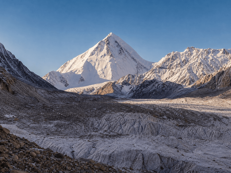
    The glacier broadens into the vast white plateau of Lukpe Lawo — Snow Lake (4,800 m). One of the world's largest sub-polar ice fields, ringed by unnamed 6,000 m peaks. The scale is disorienting in the best possible way. Walking time: 4–5 hours.

    After breakfast, the camp crew packs the shared equipment and the porter team receives the day’s allocated loads while participants carry their personal daypacks. The lead guide sets a sustainable pace over the terrain described above, with planned stops for water, food, layer changes, and regrouping before exposed, loose, or glaciated sections. On reaching camp, the team checks in with the guide, changes into dry layers, hydrates, and inspects feet and equipment. Dinner is followed by a weather, health, and route briefing for the next stage.

  12. Day12Rest Day on Snow LakeDaily route segment4,800 m

    Full rest day at Snow Lake (4,800 m). Explore the plateau on foot, photograph the surrounding peaks, and allow your body to fully acclimatise before the return descent. UV exposure at this altitude is extreme — full sun protection essential throughout the day.

    A rest or acclimatisation day is managed actively and may change with weather and team condition. Priorities are sleep, regular meals, hydration, foot care, drying clothing, charging essential devices, and repairing equipment. When appropriate, the guide leads a short, unhurried acclimatisation walk before returning to the same sleeping altitude. Each participant reports headache, nausea, unusual fatigue, sleep problems, or other concerns privately and promptly. Staff reorganise loads and supplies, and the evening briefing confirms whether the planned route can continue safely.

  13. Day13Snow Lake to Upper Biafo (Return)Daily route segment4,550 m

    Begin the return journey down the Biafo. The route is familiar and pace is typically faster than the ascent. Camp at Upper Biafo (4,550 m). Walking time: 4–5 hours.

    After breakfast, the camp crew packs the shared equipment and the porter team receives the day’s allocated loads while participants carry their personal daypacks. The lead guide sets a sustainable pace over the terrain described above, with planned stops for water, food, layer changes, and regrouping before exposed, loose, or glaciated sections. On reaching camp, the team checks in with the guide, changes into dry layers, hydrates, and inspects feet and equipment. Dinner is followed by a weather, health, and route briefing for the next stage.

  14. Day14Upper Biafo to Snake CampDaily route segment4,380 m

    Continue the descent. The glacier narrows again and moraine becomes more prominent underfoot. Camp at Snake Camp (4,380 m). Walking time: 5–6 hours.

    After breakfast, the camp crew packs the shared equipment and the porter team receives the day’s allocated loads while participants carry their personal daypacks. The lead guide sets a sustainable pace over the terrain described above, with planned stops for water, food, layer changes, and regrouping before exposed, loose, or glaciated sections. On reaching camp, the team checks in with the guide, changes into dry layers, hydrates, and inspects feet and equipment. Dinner is followed by a weather, health, and route briefing for the next stage.

  15. Day15Snake Camp to BainthaDaily route segment3,750 m

    Long descent back toward the glacier margin. The moraine transitions to more defined path as you approach Baintha. Camp at Baintha (3,750 m) — back on the last grassy ledge. Walking time: 5–6 hours.

    After breakfast, the camp crew packs the shared equipment and the porter team receives the day’s allocated loads while participants carry their personal daypacks. The lead guide sets a sustainable pace over the terrain described above, with planned stops for water, food, layer changes, and regrouping before exposed, loose, or glaciated sections. On reaching camp, the team checks in with the guide, changes into dry layers, hydrates, and inspects feet and equipment. Dinner is followed by a weather, health, and route briefing for the next stage.

  16. Day16Baintha to JoulaDaily route segment3,200 m

    Leave the glacier behind and descend through moraine terraces above the Braldu River. Camp at Joula (3,200 m). Walking time: 5–6 hours.

    After breakfast, the camp crew packs the shared equipment and the porter team receives the day’s allocated loads while participants carry their personal daypacks. The lead guide sets a sustainable pace over the terrain described above, with planned stops for water, food, layer changes, and regrouping before exposed, loose, or glaciated sections. On reaching camp, the team checks in with the guide, changes into dry layers, hydrates, and inspects feet and equipment. Dinner is followed by a weather, health, and route briefing for the next stage.

  17. Day17Joula to AskoleDaily route segment

    Final trekking day. Return to Askole via the suspension bridges over the Braldu. The village marks the end of the glacier journey. Overnight in Askole (guesthouse or camp). Walking time: 5–6 hours.

    After breakfast, the camp crew packs the shared equipment and the porter team receives the day’s allocated loads while participants carry their personal daypacks. The lead guide sets a sustainable pace over the terrain described above, with planned stops for water, food, layer changes, and regrouping before exposed, loose, or glaciated sections. On reaching camp, the team checks in with the guide, changes into dry layers, hydrates, and inspects feet and equipment. Dinner is followed by a weather, health, and route briefing for the next stage.

  18. Day18Askole to SkarduDaily route segment

    Drive back to Skardu by 4WD jeep along the Braldu Valley road. Approximately 7–8 hours. Overnight Skardu hotel — the first hot shower since Askole.

    The group leaves after breakfast with personal bags and expedition loads secured in the assigned vehicles. Namla Expeditions drivers and field staff assess road, river, traffic, and weather conditions throughout the journey; stops are made for permits, meals, photography, and comfort only where parking is safe. Travel time can change after landslides or road works, so the day remains flexible. On arrival, rooms or tents are allocated, luggage is checked, and the guide gives a short briefing before dinner and rest.

  19. Day19Skardu to IslamabadDaily route segment

    Fly from Skardu to Islamabad (1 hour) or drive the Karakoram Highway. Mountain-weather delays are possible. Overnight Islamabad hotel.

    The operations team checks the latest airline and weather information before leaving the hotel and coordinates the airport transfer, tickets, and expedition baggage. Mountain flights remain weather-dependent; if a cancellation occurs, Namla Expeditions explains the available road contingency and revises later stages without compressing essential acclimatisation or safety time. After landing, the group collects all luggage before transferring to the hotel. A short arrival briefing covers meals, local timing, equipment access, and the next day’s plan.

  20. Day20DepartureCompletion day

    Depart Islamabad International Airport. Transfer at the appropriate time for your international flight.

    The operations team checks the latest airline and weather information before leaving the hotel and coordinates the airport transfer, tickets, and expedition baggage. Mountain flights remain weather-dependent; if a cancellation occurs, Namla Expeditions explains the available road contingency and revises later stages without compressing essential acclimatisation or safety time. After landing, the group collects all luggage before transferring to the hotel. A short arrival briefing covers meals, local timing, equipment access, and the next day’s plan.

Field Planning

Prepare for the Journey

Fitness

Preparation & Fitness

Difficulty Rating: Hard

The difficulty is sustained rather than technical: 12 days of continuous glacier travel on broken ice and moraine, at altitudes between 3,750 m and 4,800 m, in remote terrain with no road access and limited rescue options. No crampon terrain and no technical risk — but real trekking fitness is non-negotiable.

Begin 3–4 months before departure:

  • Five-hour hikes with a 10–12 kg pack, 4 days per week
  • Aerobic exercise — running or cycling — 3 times per week
  • Leg-strengthening work: squats and step-ups
  • Prior trekking at altitude above 3,500 m within 12 months of departure (recommended)

Required Personal Gear

  • Stiff trekking boots with ankle support and rigid sole
  • Gaiters
  • Trekking poles
  • Sleeping bag rated to −15°C minimum
  • Full layering system — base, mid-layer, wind/waterproof shell
  • Sun protection — SPF 50+, glacier goggles or quality UV400 sunglasses, sun hat, gloves
Safety

Safety & Logistics

Medical Preparedness

All Namla Expeditions guides hold Wilderness First Aid certification and carry HACE/HAPE emergency medications (Dexamethasone, Nifedipine). The team carries a satellite communicator at all times. An emergency evacuation plan is filed with PTDC before departure. Helicopter evacuation from the glacier is possible in good weather.

Porter Welfare

All porters receive GBTA-mandated insurance, appropriate footwear, and weather-protective clothing. Loads are capped at 25 kg. Porters are briefed on route conditions and emergency procedures before departure.

Permits

The Biafo Trekking Area Permit is processed through official PTDC and Gilgit-Baltistan Tourism channels. We require passport copies and NTS forms at least 3 weeks before departure.

Permits

Permits & Local Operations

Permits

All trekking permits are arranged by Namla Expeditions as part of the package: the Biafo Trekking Area Permit issued by Gilgit-Baltistan Tourism and any required No Objection Certificate. We require full passport copies and NTS forms at least 3 weeks before departure. Processing typically takes 5–7 working days.

Logistics

The trek begins and ends in Askole (3,040 m), reached by 4WD jeep from Skardu along the rough Braldu Valley road (approximately 7–8 hours). Unlike the Hispar La traverse, no vehicle pre-positioning on the Hunza side is required — the same vehicles that deliver you to Askole wait for your return. All transport and porter logistics are handled in-house.

Porters

For a group of 6–8 trekkers, expect 18–24 porters for the return journey. Porter wages, insurance, footwear, and weather-protective clothing are provided per GBTA regulations. Loads are capped at 25 kg. Kitchen staff (head cook and assistant) are included.

Accommodation

All trekking nights are in four-season expedition tents with sleeping mats. Trekkers supply their own sleeping bag (rated −15°C minimum). Nights in Islamabad and Skardu are in hotels (twin-share; upgrades available on request).

What's Covered

Inclusions & Exclusions

Included

  • All ground transport — Islamabad–Skardu–Askole and return to Islamabad
  • Four-season expedition tents, sleeping mats, kitchen tent, and dining tent
  • All meals during the trek — breakfast, packed lunch, dinner, hot drinks, and snacks
  • Licensed English-speaking head guide
  • Assistant guide
  • Experienced cook and kitchen assistant
  • All porters for gear, food, and kitchen equipment
  • Porter insurance, GBTA-compliant wages, boots, and weather-protective clothing
  • All trekking permits and Biafo area entry fees
  • Group first aid kit including HACE/HAPE emergency medications (Dexamethasone, Nifedipine)
  • Satellite communicator and emergency evacuation plan filed with PTDC
  • Welcome dinner in Skardu and pre-departure briefing
  • Hotel accommodation in Islamabad and Skardu (twin-share)

Not Included

  • International flights to/from Islamabad
  • Pakistan e-visa fee
  • Domestic flight Islamabad–Skardu (if taken — approx. USD 80 each way)
  • Travel insurance with helicopter evacuation cover — mandatory, not included
  • Personal trekking gear — sleeping bag (−15°C rated), trekking poles, stiff trekking boots, gaiters
  • Tips for guides, cook, and porters — customary and gratefully received
  • Personal snacks and bottled drinks beyond provided meals
  • Costs arising from flight cancellations, weather delays, or road closures
  • Personal medical or evacuation expenses
  • Alcoholic beverages

Common Questions

Frequently Asked Questions

How does the Biafo Glacier Trek differ from the Snow Lake & Hispar La traverse?

The key difference is the Hispar La pass (5,151 m). The Biafo Glacier Trek goes to Snow Lake and returns the same way — no technical pass crossing, no pre-positioned vehicle on the Hunza side. Maximum altitude is 4,800 m. It is shorter (20 days vs. 23), logistically simpler, and accessible to trekkers without crampon experience.

Do I need glacier or crampon experience?

Crampon experience is not required for this route. The Biafo Glacier surface is challenging — rough moraine, ice channels, and meltwater — but involves no technical climbing. Strong trekking fitness and comfort at altitude are the primary requirements. Guides provide glacier travel orientation at the start of the route.

When is the best time to trek the Biafo Glacier?

July to early September is the optimal window. June can bring unstable snow bridges and higher river crossings on the approach from Askole. By mid-September the weather window closes rapidly and temperatures at Snow Lake (4,800 m) fall well below freezing at night.

How many porters are needed?

For a group of 6 trekkers, expect 18–24 porters covering gear and kitchen staff. We handle all porter logistics per GBTA regulations. Loads are capped at 25 kg.

What is the altitude risk?

The highest camp is Snow Lake at 4,800 m. Most trekkers spend 2–3 nights above 4,500 m. AMS risk is lower than on the Hispar La traverse, but it is real. The acclimatisation rest day at Upper Biafo (4,550 m) is an important buffer. Guides carry HACE/HAPE emergency medications. Anyone with severe AMS symptoms must descend.

Can I combine the Biafo Glacier Trek with a K2 Base Camp visit?

The Biafo and Baltoro glaciers are parallel systems and do not connect by a trekking route. To combine both, you return to Askole and drive to the Baltoro trailhead via Skardu. Contact us about multi-week itineraries that incorporate both glacier systems.

From the Field Notes

From the same region

Related Journeys

Start Your Journey

Plan Biafo Glacier Trek with our local team

Reach our team directly. No booking system, no automated responses — a direct line to the people who run these routes.

Price on request