In this field note11 sections +Close −
- 01Key facts
- 02What happened on the Nepal–Tibet border?
- 03How high-mountain flood chains work
- 04Why the Nepal disaster matters to the Karakoram
- 05Protecting the Karakoram before disaster
- 06What Expedition Operators Must Do
- 07Preparedness checklist for visitors and mountain operators
- 08A warning that can still become protection
- 09Frequently asked questions
- 10External references
- 11Author’s note
Editorial note — developing event: This article was researched on 27 August 2026. Search-and-rescue operations in Nepal and the Tibet Autonomous Region were continuing, and official casualty and missing-person figures were changing rapidly. The physical trigger also remained under investigation. Editors must check the latest Nepal government, ReliefWeb and established news-agency updates before revising or republishing this Field Note.
On 26 August 2026, a violent surge of water, mud, rock and boulders swept through Nepal’s Rasuwa district near the border with China’s Tibet Autonomous Region. It entered the Bhote Koshi and Trishuli river systems, destroying lives, settlements and critical infrastructure along a narrow Himalayan corridor.
For families waiting for news, this is not a climate metaphor or a dramatic story from a distant mountain range. It is a human disaster. Any lesson drawn from it must begin with respect for those killed, missing, injured or displaced, and for the rescuers still working in unstable terrain.
The Karakoram is not geographically identical to Rasuwa. Its glaciers behave differently, its valleys receive different combinations of monsoon and winter precipitation, and its communities, roads and tourism corridors have their own patterns of exposure. It would be scientifically irresponsible to claim that Nepal’s event predicts an identical disaster in Askole, Shigar or Skardu.
But it would be equally irresponsible to ignore the shared lesson: mountain hazards often develop as chains, not isolated events. Monitoring only a lake, a glacier or the weather may miss the interaction between them.
Key facts
The flood entered Nepal’s Rasuwa district on the morning of 26 August 2026 and travelled through the Bhote Koshi into the Trishuli river system.
Confirmed reporting describes a fast-moving mixture of water, sediment and boulders, with severe loss of life and infrastructure.
ICIMOD’s initial assessment considers an ice-rock avalanche entering the Lende Khola catchment a possible trigger.
Scientists are also investigating whether debris temporarily blocked a river, creating an unstable natural dam and a secondary flood risk.
The precise sequence, volume and role of climate conditions are not yet confirmed.
This event should not yet be described definitively as a classic glacial lake outburst flood.
Pakistan already recognises Shigar, Skardu and other Gilgit-Baltistan districts as exposed to GLOFs, flash floods and landslides.
Preparedness must address several hazards together: ice, rock, lakes, rainfall, debris, river constrictions and infrastructure failure.
What happened on the Nepal–Tibet border?
The flood struck Rasuwa at around 9:00 a.m. local time, according to an initial ICIMOD scientific advisory. It carried water, mud, large rocks and other debris through the Bhote Koshi system and downstream into the Trishuli.
ICIMOD reported extraordinary changes at downstream river gauges. The Trishuli reportedly rose by as much as nine metres within 30 minutes at Galchhi and seven metres over a similar period at Malekhu. Some monitoring stations were damaged or washed away. Those measurements are important, but they remain part of a preliminary event assessment rather than a completed scientific reconstruction.
Reuters reporting confirmed extensive destruction and an ongoing search for missing residents, security personnel, workers and visitors. Nepal’s Ministry of Foreign Affairs established an emergency team for foreign nationals affected by the disaster.
### What is confirmed
The date, affected river corridor, destructive debris-rich flood and extensive human and infrastructure losses are confirmed. Authorities issued evacuations and downstream warnings while search-and-rescue operations continued.
### What remains preliminary
ICIMOD scientists and partners are investigating whether a large ice-rock avalanche entered a tributary high in the catchment. Video, remote-sensing information and unusual seismic signals support investigation of that possibility, but ICIMOD explicitly stated that the trigger had not been confirmed.
Researchers are also examining whether ice and rock temporarily blocked the river. If such a barrier impounded water and then failed or overflowed, it could explain part of the sudden surge. At the time of writing, the exact sequence had not been established.
It is also too early to assign a quantified role to climate change in this individual event. Warming is transforming glaciers, permafrost, snow and high mountain slopes across the region, but attributing one disaster requires a dedicated event study.
How high-mountain flood chains work
### Ice-rock avalanches
An ice-rock avalanche begins when a mass containing glacier ice, snow and bedrock detaches from a steep slope. Gravity accelerates it downslope. The moving material can fragment, spread and collect additional debris.
If it strikes a river or lake, it can displace water suddenly, like a large object dropped into a confined container. It may also block a narrow channel. Water then accumulates behind the blockage until it seeps through, overtops or breaks it.
Slope geometry, fractured rock, earthquakes, freeze-thaw cycles, erosion and water pressure can all contribute. Warming and permafrost degradation can reduce the strength of frozen material that once helped bind steep slopes, but the importance of each factor must be established for each event.
### Glacial lake outburst floods
A glacial lake outburst flood, or GLOF, is a sudden release of water stored beside, beneath, within or in front of a glacier. Some lakes are retained by moraine—the loose rock and sediment deposited by ice. Others are held back by glacier ice.
A lake does not become dangerous merely because it is growing. Risk depends on its volume, dam structure, drainage, surrounding slopes and what lies downstream. An avalanche can generate a displacement wave that overtops a moraine. Internal erosion, melting ice, rainfall or rising water pressure can also weaken a natural dam.
ICIMOD has mapped more than 25,000 glacial lakes across major Hindu Kush Himalayan river basins, but stresses that important knowledge gaps remain. Its GLOF overview explains why inventories must be followed by site-specific monitoring and downstream exposure studies.
The 2024 flood at Thame in Nepal illustrates the complexity. A later field investigation found that a rock avalanche struck an upper glacial lake, generated a displacement wave and contributed to successive lake breaches. That conclusion followed fieldwork and detailed analysis; it was not established from the first images. The ICIMOD Thame study shows why early explanations must remain provisional.
### Landslide-dammed lakes
A landslide or avalanche can block a river with rock, soil, ice and timber. Water pools behind this temporary dam, sometimes with little warning downstream.
Pakistan has direct experience of this process. The 2010 Attabad landslide blocked the Hunza River, formed a lake, inundated settlements and submerged part of the Karakoram Highway. NASA Earth Observatory documented the lake and concern over a possible downstream breach.
### Glacier retreat and glacier surging
Across much of High Mountain Asia, glacier retreat can expose depressions where meltwater collects. It can also leave loose sediment and steep, recently uncovered slopes. The IPCC Sixth Assessment finds strong evidence that cryosphere change is altering mountain water cycles and interacting with floods, slope instability and other hazards.
The Karakoram requires special care in interpretation. Some glaciers have historically remained stable, gained mass or surged forward—the pattern often called the Karakoram anomaly. This does not mean the range is protected from climate risk.
A surging glacier can advance into a river and create an ice-dammed lake. Research on Karakoram surge-related outburst floods shows that advancing ice can repeatedly form and release such lakes. NASA has described the same mechanism in Shimshal Valley.
The practical conclusion is not that every Karakoram glacier is retreating uniformly. It is that retreating, stable and surging glaciers all require observation because they produce different hazards.
### Extreme rainfall
Extreme rainfall can generate dangerous runoff without a glacial lake. Water moves rapidly across steep rock and sparsely vegetated slopes, entering gullies and tributaries. It can mobilise old landslide deposits, erode riverbanks and turn a water flood into a dense debris flow.
Rain can also interact with snowmelt or glacier melt. Several moderate processes occurring together may create a larger flood than any one process alone.
A 2026 peer-reviewed Shigar Basin hydrology study projects changes in rainfall, temperature and runoff under future climate scenarios. These are basin-scale projections, not predictions of a particular disaster in Askole or Skardu. Their value is in showing why climate, snow, glacier and river monitoring should be integrated.
Why the Nepal disaster matters to the Karakoram
Nepal’s Rasuwa corridor and Pakistan’s central Karakoram differ in glacier type, seasonal weather, elevation, valley orientation and river systems. A warning should therefore transfer as a planning principle, not as a claim of identical danger.
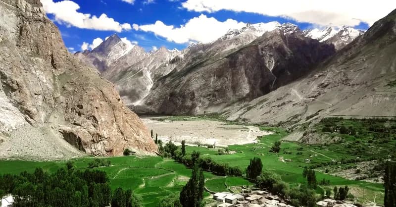
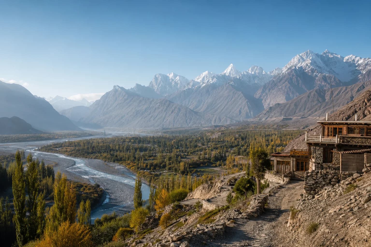
The shared concern is exposure within narrow valleys. Askole is a gateway to the Braldu and Baltoro trekking corridors. People, vehicles, bridges, camps and supply movements often depend on a limited route with few alternatives. A damaged bridge or blocked road can isolate communities and expedition teams even when a settlement itself is not directly struck.
Shigar contains homes, farmland, roads and public infrastructure along a glacier-fed river system. Skardu is the region’s main logistics and service centre. Disruption upstream can affect transport, food and fuel movement, emergency response, tourism schedules and downstream river conditions.
The Government of Gilgit-Baltistan’s disaster planning identifies Shigar and Skardu among districts exposed to floods, GLOFs, landslides and related hazards. An NDMA-linked alert issued on 17 August 2026 also named both areas when warning about the combined effects of glacier and snow melt, elevated temperatures, rainfall and thunderstorms.
That does not establish that Askole or a specific campsite lies inside a modelled flood zone. Such a claim requires a current local hazard assessment. It does establish that precautionary planning is justified.
### Villages and downstream communities
A flood’s source may be far from the people who experience its greatest consequences. As water moves downstream, it can erode terraces, redirect channels and collect sediment from tributaries. Communities outside an obvious glacier-viewing area may still be exposed.
Warnings must travel downstream faster than the flood and reach people who may not use smartphones, speak the same language or have uninterrupted electricity.
### Bridges and roads
Bridges are both lifelines and potential failure points. Narrow openings can trap boulders and timber, forcing water around abutments or onto the road. A bridge may remain standing but become unsafe because its foundations have been scoured.
Road cuts can destabilise slopes, while blocked culverts redirect water into homes or across the carriageway. Post-flood reopening must depend on engineering inspection, not the absence of visible water.
### Trekking corridors and campsites
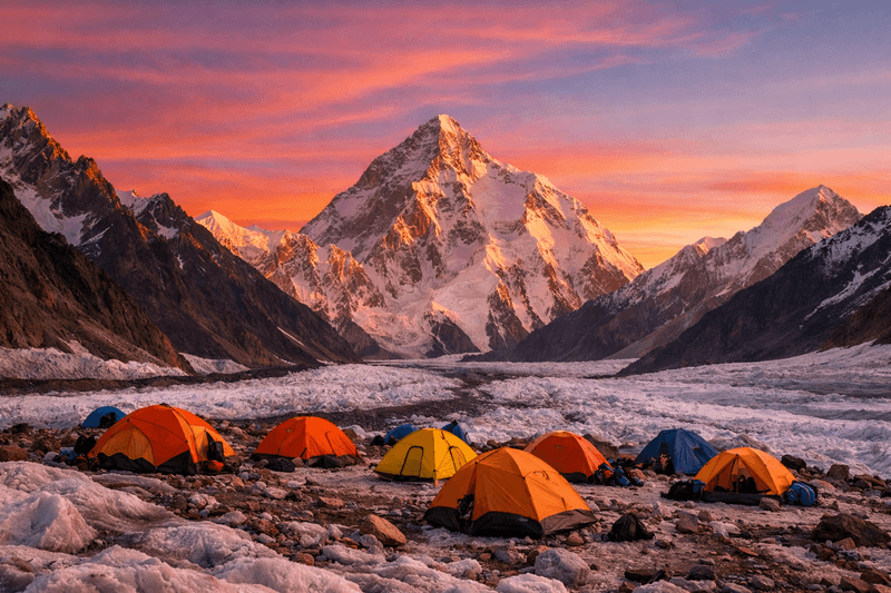
A campsite that is comfortable in normal weather may be unsafe during an unusual flood. River terraces, dry channels, tributary mouths, debris fans and the area immediately below steep gullies deserve particular scrutiny.
Operators must consider hazards above the camp—not only the river beside it. A slope failure or sudden tributary surge can reach a site that appears elevated relative to the main channel.
Protecting the Karakoram before disaster
### Monitor glaciers, lakes, slopes and rivers together
Satellite imagery can identify changes in lake area, glacier movement and large slope failures. Ground instruments can measure rainfall, river level, temperature, seismic signals and movement in unstable terrain. Local observers can report blocked streams, new cracks, unusual sounds, muddy water or rapidly changing flow.
None is sufficient alone. A resilient monitoring system combines scientific instruments with community observation and assigns responsibility for reviewing the information.
Pakistan’s government and UNDP already have a foundation through the GLOF-II programme, which supports community-based early warnings and adaptation across 24 vulnerable valleys. In 2025, the Ministry of Climate Change reported early-warning and protective works in Shigar. Those systems need long-term maintenance, trained local operators and transparent performance reviews.
### Build community-based early-warning systems
A sensor is not an early-warning system unless its message reaches people who know what to do.
Warnings should use several channels: sirens, mosque or village loudspeakers, radio, mobile alerts, satellite communication and trained messengers. Signals must have agreed meanings and trigger actions automatically. If every warning requires lengthy approval, the flood may arrive first.
Systems should account for power failures and damaged mobile towers. Every exposed settlement and campsite needs a designated higher location, more than one route where possible, and support for children, older people, visitors and people with disabilities.
### Map hazards and establish safe construction zones
Hazard maps should model multiple scenarios, including GLOFs, temporary river dams, debris flows, extreme rainfall and bridge blockage. They must show depth, speed, arrival time and evacuation constraints—not just the outline of a historic flood.
Maps should guide new homes, hotels, warehouses, bridges, campsites and tourism facilities. Critical services should not be concentrated in one exposed corridor. Where relocation is impossible, authorities should identify realistic structural protection and evacuation measures.
### Practise evacuation before it is needed
Routes that work on a map may fail at night, in rain or when a bridge is gone. Communities, schools, road crews and tourism operators should conduct seasonal drills.
A drill should test how long notification takes, whether the route is physically passable, who checks remote households, where visitors assemble and how authorities confirm that an area has been cleared. Lessons should be documented and corrected.
### Strengthen bridges, roads and communications
New bridges should be designed using updated debris-flow and flood estimates, with adequate freeboard and protection against foundation scour. Existing bridges need inspection before and after high-flow periods.
Road planning should include slope drainage, culvert capacity, controlled spoil disposal and safe stopping areas away from gullies. Communications need redundancy: mobile networks where available, radio between vehicles and camps, satellite devices for remote teams, and scheduled check-ins.
### Manage campsites and waste responsibly
Waste management is not a substitute for climate adaptation, and litter does not cause a GLOF. But unmanaged waste can block small drainage paths, contaminate emergency water sources and complicate evacuation and recovery.
The Central Karakoram National Park’s established approach includes visitor registration, campsite management, portable sanitation, waste collection and removal from glaciated areas. Its mountain-protection programme emphasises prevention and participation by guides, cooks, porters, operators and visitors.
Every group should carry out solid waste, manage human waste according to current park rules, protect watercourses and document what returns from the mountain.
### Put local people at the centre
Guides, porters, drivers and residents often notice changes before outside teams do. Their observations should inform monitoring, route decisions and warning thresholds. Participation must include training, pay, equipment and decision-making authority; it cannot mean asking communities to carry responsibility without resources.
Scientists, district authorities, emergency services, park management and tourism operators should share usable information. Technical monitoring is most effective when it leads to a clear local action rather than remaining inside a report.
What Expedition Operators Must Do
A responsible operator is not expected to replace glaciologists, engineers or disaster authorities. It is expected to act competently on official information, local knowledge and observable conditions.
Before the season, operators should maintain a written hazard register for each itinerary. It should identify river crossings, bridges, exposed road sections, tributary mouths, camps below unstable slopes, communication gaps and alternative stopping points.
Before each departure, the operator should:
Review current PMD, NDMA, GBDMA and district-administration advisories.
Confirm road, bridge and trail conditions through reliable local contacts.
Record every traveller, guide, cook, driver and porter on an accurate manifest.
Test radios, satellite devices, batteries and emergency contacts.
Define missed-check-in procedures and who will initiate them.
Review campsite choices against current river and slope conditions.
Brief the entire team in language they understand.
During the journey, the lead guide must have authority to delay, reroute or turn back without commercial pressure. A schedule, summit objective or client expectation cannot take priority over an official warning or deteriorating conditions.
Teams should never stop on a bridge to watch a flood, enter a dry channel during unstable weather, or approach a newly formed lake or river blockage. After an avalanche or landslide, assume downstream conditions can change again.
Operators should share useful, non-personal observations with authorities: the time and location of unusual water colour, falling river levels, new cracks, damaged bridges or blocked channels. Such observations must be reported as observations—not promoted online as scientific conclusions.
Local guides and porters must participate in route and campsite decisions. They often recognise changes that a visiting team will miss. Their knowledge should be combined with forecasts, instruments and official instructions, not treated as decorative local insight after decisions have already been made.
Finally, operators should communicate honestly. Hazard information should never be minimised to protect a booking or exaggerated to market an expedition as extreme.
Preparedness checklist for visitors and mountain operators
Official weather, flood, GLOF and landslide advisories have been checked.
The road, bridges and intended campsites have current local confirmation.
Every team member appears on the manifest with an emergency contact.
The guide has authority to change or cancel the itinerary.
Primary and backup communication devices have been tested.
Check-in times and missed-contact escalation steps are documented.
The team knows the warning signal and nearest safe high ground.
Camps are outside dry channels, tributary mouths and obvious debris paths.
Nobody will cross or approach fast, rising or newly muddy water.
Essential medicine, insulation, water treatment and emergency food are accessible.
Waste and sanitation plans comply with current park requirements.
Porters and staff receive the same safety briefing as clients.
Conditions will be reassessed daily, not only at the start of the trip.
A warning that can still become protection
The lesson from Nepal is not that every glacial lake will burst or that every Karakoram journey has become unsafe. It is that low-frequency mountain hazards can have enormous consequences when monitoring, communication, land use and evacuation planning fail to keep pace with a changing environment.
Protection begins with patient work: measuring glaciers and rivers, mapping where water and debris may travel, maintaining instruments, strengthening bridges, rehearsing evacuations and listening to the people who live and work in these valleys.
For Namla Expeditions, responsibility means treating safety and environmental care as continuous local duties, while recognising that scientific assessment belongs to qualified researchers and public authorities.
The next disaster cannot always be prevented. Loss of life can often be reduced. The time to agree on warning signals, safe ground, communication responsibilities and no-go decisions is before the river rises.
Frequently asked questions
### Is the August 2026 Nepal flood confirmed as a GLOF?
Not yet. A major debris-rich flood is confirmed, but the initiating process remains under investigation. ICIMOD’s preliminary assessment considers an ice-rock avalanche and temporary river blockage possible. Until a scientific reconstruction is completed, calling it definitively a classic GLOF would go beyond the evidence.
### Could the same event happen in Askole?
Nepal and Askole do not have identical geography or hazard systems, so a direct prediction would be irresponsible. Askole is, however, part of a steep glacier-fed valley corridor where floods, debris flows, landslides, bridge loss and road isolation are credible planning concerns. Its specific exposure must be established through current local mapping.
### Does the Karakoram anomaly mean its glaciers are safe?
No. The term describes unusual stability or mass gain observed in parts of the Karakoram during certain periods. Individual glaciers behave differently, and some surge. Advancing ice can dam rivers and create outburst-flood hazards, while warming, rainfall and slope instability introduce other risks.
### What warning signs should visitors recognise?
Rapidly rising or suddenly falling river levels, newly muddy water, unusual vibration or roaring, repeated rockfall, fresh cracks, a blocked stream, official alerts and urgent instructions from local residents all require immediate attention. People should move away from channels and toward designated safe ground rather than stopping to investigate.
### Who should decide whether an expedition continues?
The lead local guide and operator should make a conservative decision using official advisories, current route information and field observations. Authorities may close an area or order evacuation. Clients and commercial schedules must never override those decisions.
External references
Pakistan Ministry of Climate Change — GLOF-II work in Shigar
Peer-reviewed research — Climate and hydrology in the Shigar Basin
Peer-reviewed research — Surge-related GLOF hazards in the Karakoram
Author’s note
This Field Note is an evidence-based editorial interpretation for Namla Expeditions. It is not a site-specific hazard map, weather forecast or substitute for instructions from NDMA, GBDMA, PMD, district authorities, park management or emergency services. Namla Expeditions is presented as a responsible local operator and participant in risk reduction—not as the scientific authority determining the cause of the Nepal disaster.
Last updated: 27 August 2026.
End of field note
Continue your research.
Browse all notes