In this field note43 sections +Close −
- 011. Executive summary
- 022. Why climb K2?
- 033. K2 quick facts
- 044. Mountain overview
- 055. History of the mountain
- 066. Exploration history
- 077. The first ascent
- 088. Important historical milestones
- 099. Location
- 1010. Abruzzi Spur route overview
- 1111. Detailed route description
- 1212. Camp layout and purpose
- 1313. Route map explanation
- 1414. Difficulty and technical grade
- 1515. Required experience
- 1616. Physical requirements
- 1717. Previous climbs recommended
- 1818. Best season
- 1919. Weather by month
- 2020. Acclimatisation strategy
- 2121. Expedition timeline
- 2222. Personal equipment checklist
- 2323. Group equipment
- 2424. Clothing guide
- 2525. Food and nutrition
- 2626. Water management
- 2727. Expedition logistics
- 2828. Permits
- 2929. Letter of invitation
- 3030. Visa requirements
- 3131. Insurance requirements
- 3232. Helicopter rescue
- 3333. Base-camp life
- 3434. Communication, electricity and charging
- 3535. Waste management and environmental responsibility
- 3636. Common hazards
- 3737. Summit strategy
- 3838. Descent strategy
- 3939. Emergency response
- 4040. Estimated budget breakdown
- 4141. Why choose Namla Expeditions
- 4242. Frequently asked questions
- 4343. Conclusion
K2 is not a peak to approach through reputation alone. It is an 8,611-metre mountain with sustained technical climbing, serious objective hazard, complex weather and very limited rescue options. A successful expedition begins with an honest assessment of the climber, then builds a patient acclimatisation and logistics system around the mountain.
Namla Expeditions plans K2 operations from Skardu and Askole. Our work starts months before the first porter load leaves the roadhead. Permits, freight, food, fuel, staff insurance, base-camp systems, communications, high-altitude equipment and evacuation procedures all have to connect. Once the team enters the Baltoro, a missing item or weak assumption is difficult to correct.
This guide uses the Abruzzi Spur as the reference route because it is the line attempted by most commercial and independent teams. It is not a promise of fixed camp positions or conditions. Snow cover, crevasses, rockfall, fixed lines and the condition of the Bottleneck change from season to season.
Field note: K2 demands independent judgement. Fixed ropes, high-altitude workers and bottled oxygen may support a climb, but they do not turn the mountain into a guided trail.
1. Executive summary
K2 stands at 8,611 metres in the central Karakoram. It is the second-highest mountain on earth and one of the most technically sustained of the fourteen 8,000-metre peaks. The normal access from Baltistan follows the road from Skardu through Shigar to Askole, then the trekking route through Paiju, the Baltoro Glacier, Concordia and the Godwin-Austen Glacier to base camp.
Most teams attempt the Abruzzi Spur on the south-east ridge. The line typically uses four high camps, although their exact elevations and positions vary. Key sections include steep lower snow and mixed ground, the House Chimney, the Black Pyramid, the Shoulder and the Bottleneck beneath unstable hanging ice.
A normal expedition allocation is approximately eight weeks from international arrival to departure. Weather, road access, acclimatisation, route fixing and team health may require more time. Summit success is never guaranteed.
K2 is appropriate only for climbers with strong technical mountaineering ability, previous expedition experience above 7,000 metres and, in most cases, earlier exposure to an 8,000-metre environment. Efficient fixed-line movement, cold camp management, glacier rescue knowledge and conservative decision-making are essential.
2. Why climb K2?
K2 attracts mountaineers because the climb remains complete. The approach is long. The base camp is remote. The route demands competence from its lower slopes to the summit ridge. Altitude is only one part of the problem.
The mountain also requires patience. A climber may spend weeks acclimatising, carrying loads and waiting at base camp, then decide not to enter a short summit window. That decision can represent good mountaineering rather than failure.
We normally recommend K2 to climbers who are motivated by the quality and seriousness of the expedition, not by completing a list. If the main objective is simply to stand on any 8,000-metre summit, K2 is rarely the sensible first choice.
3. K2 quick facts
Item — Detail
Elevation — 8,611 metres
Global ranking — Second-highest mountain
Range — Karakoram
Local operating hub — Skardu
Roadhead — Askole
Main approach — Baltoro and Godwin-Austen glaciers
Reference climbing route — Abruzzi Spur
Typical expedition allocation — About 55–65 days
Usual climbing season — June to August
Common number of high camps — Four, subject to conditions
Base-camp elevation — Approximately 5,150 metres
Technical character — Snow, ice, mixed climbing, rock and fixed-line movement
Principal upper hazard — Bottleneck and serac exposure
Permit — Required
Rescue — Weather-, altitude- and availability-dependent
All elevations above base camp should be treated as approximate. GPS devices differ, camps move and the safest available platform changes.
4. Mountain overview
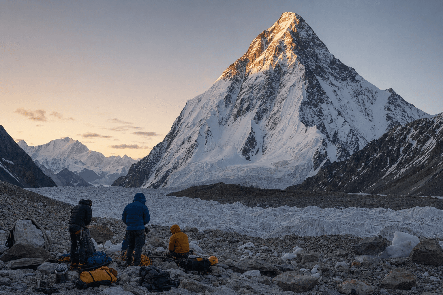
K2 rises sharply above the glaciers around the upper Baltoro. Unlike a broad plateau peak, it presents steep ridges and faces in every direction. The mountain’s relief is immediate from base camp, and there is little easy ground on the normal route.
The south-east ridge gains height through a series of distinct technical bands. Lower snow slopes lead towards Camp I. Mixed ground and the House Chimney guard the approach to Camp II. The Black Pyramid forms the most continuously technical middle section. Above it, the terrain opens towards Camp III and the Shoulder, but altitude, avalanche exposure and wind remain serious. The Bottleneck then concentrates climbers beneath a large serac before the final summit slopes.
K2’s difficulty comes from accumulation. A section that would be manageable at 5,000 metres becomes slow and serious above 7,000 metres. A minor equipment fault, delayed start or hydration problem can consume the reserve needed for descent.
5. History of the mountain
K2 was recorded during the Great Trigonometrical Survey in 1856. Surveyor Thomas George Montgomerie labelled two prominent Karakoram summits K1 and K2 from a distant observation point. K1 later became widely known as Masherbrum. The survey label K2 remained in international use.
The mountain has also been associated with names including Mount Godwin-Austen and Chhogori, though the history and everyday use of these names are not identical. In Baltistan, people commonly understand K2 directly. Responsible writing should avoid claiming one convenient translation as an uncontested ancient local name.
Early expeditions approached through a region with no modern road network, satellite forecast or lightweight equipment. Their surveys established much of the geographical knowledge later teams used.
6. Exploration history
In 1902, an international group led by Oscar Eckenstein, with Aleister Crowley among its members, made the first serious attempt. The expedition explored the north-east side and reached approximately 6,500 metres. Illness, weather and internal difficulties prevented further progress, but the attempt demonstrated the scale of the undertaking.
The 1909 Duke of the Abruzzi expedition examined several possible lines. Its climbers attempted the south-east ridge to roughly 6,250 metres before concluding that the route was not practical with the equipment of the period. That ridge later became the standard Abruzzi Spur.
American expeditions in 1938 and 1939 advanced knowledge of the route. The 1938 team led by Charles Houston climbed high on the Abruzzi Spur and identified a viable sequence. The following year, Fritz Wiessner climbed very high but the expedition ended in tragedy during a breakdown of support and descent.
In 1953, Houston returned with a strong American team. When Art Gilkey became critically ill high on the mountain, the group abandoned its summit plans and attempted a difficult rescue. Gilkey was lost, but the team’s effort and the famous arrest of a multi-person fall became central episodes in K2’s history.
7. The first ascent
Achille Compagnoni and Lino Lacedelli reached the summit on 31 July 1954 as members of an Italian expedition led by Ardito Desio. Their ascent followed the Abruzzi Spur and used supplementary oxygen.
The expedition also produced a long-running controversy involving Walter Bonatti and Pakistani high-altitude porter Amir Mahdi. After carrying oxygen towards the summit team, Bonatti and Mahdi were forced to bivouac at extreme altitude. Mahdi suffered severe frostbite. Later accounts disputed camp placement, oxygen use and the treatment of the support pair.
For modern operators, this history is not only a summit story. It is a reminder that communication, staff welfare, clear decisions and accurate reporting are part of expedition ethics.
8. Important historical milestones
- 1856: K2 is recorded during the Great Trigonometrical Survey.
- 1902: First serious climbing expedition.
- 1909: Duke of the Abruzzi expedition explores the south-east ridge.
- 1938: Charles Houston’s team establishes much of the future normal route.
- 1939: Fritz Wiessner climbs high; the expedition ends in tragedy.
- 1953: The American expedition attempts to evacuate Art Gilkey.
- 1954: Compagnoni and Lacedelli complete the first ascent.
- 1977: A large Japanese expedition makes the second ascent.
- 1978: An American team reaches the summit; Louis Reichardt climbs without supplementary oxygen.
- 1986: Multiple fatalities during the season lead to the description “Black Summer”.
- 2008: A major accident around the Bottleneck and upper mountain kills eleven climbers.
- 2021: A Nepali team completes the first winter ascent.
Milestones should not be treated as a complete record. Pakistani climbers, high-altitude workers and expedition staff have often received less international attention than visiting summit teams despite their central contribution.
9. Location
K2 lies in the central Karakoram on the boundary between Gilgit-Baltistan and the Xinjiang region administered by China. Expeditions approaching from Baltistan operate on the mountain’s southern side.
Skardu is the principal logistics hub. Cargo, food, fuel, permits, hotel arrangements, staff and vehicles are organised there. Teams drive through Shigar and the Braldu Valley towards Askole, the final permanent village on the standard approach.
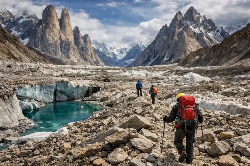
From Askole, the route passes Jhola, Paiju, Khoburtse, Urdukas and Goro before reaching Concordia. The Godwin-Austen Glacier leads north from Concordia towards Broad Peak and K2 base camps.
10. Abruzzi Spur route overview
The Abruzzi Spur follows K2’s south-east ridge. It is the most frequently attempted line, but “normal route” should not be confused with easy or safe.
The route is commonly divided as follows:
- Base Camp to Advanced Base Camp and Camp I
- Camp I to Camp II through mixed terrain and the House Chimney
- Camp II to Camp III through the Black Pyramid
- Camp III to Camp IV on or near the Shoulder
- Camp IV through the Bottleneck and traverse to the summit
- Descent by the same general line
Fixed ropes are often installed on major sections through cooperative work or a designated fixing team. Their presence and condition must be checked. A rope may be damaged, poorly anchored, buried, overloaded or connected to an uncertain anchor.
11. Detailed route description
Base Camp to Advanced Base Camp
K2 Base Camp sits on glacial moraine at roughly 5,150 metres. The approach towards Advanced Base Camp crosses changing glacier terrain. Crevasses, loose rock and meltwater alter the best line.
Advanced Base Camp is often placed around 5,300 metres, close enough to improve access to the route but exposed to glacier movement and falling debris in some locations. Teams may cache equipment here rather than occupy it continuously.
Advanced Base Camp to Camp I
The lower route moves over glacier and increasingly steep snow. Camp I is commonly established near 6,000–6,100 metres. The platform is rarely spacious. Tent security, anchor quality and protection from falling material require careful attention.
This stage introduces the working rhythm of the mountain: early starts, ascender management, clipped transitions and controlled movement around other climbers.
Camp I to Camp II
The ridge becomes more technical. Mixed rock and ice lead towards the House Chimney, a steep rock feature generally protected by fixed rope. With a pack, crampons and heavy gloves, efficient movement matters more than elegant climbing.
Camp II is often around 6,650–6,750 metres. It is exposed to wind and may have limited tent platforms. Equipment left here must be secured against storms.
Camp II through the Black Pyramid
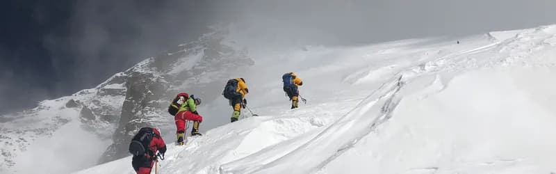
The Black Pyramid is a complex band of rock, snow and mixed ground extending towards approximately 7,300 metres. It is one of the most sustained technical sections of the Abruzzi Spur.
Rockfall can increase as temperatures rise or when many climbers move above. Parties should avoid bunching beneath constrictions. Passing on fixed ropes needs communication and patience.
Camp III is generally placed around 7,200–7,400 metres, depending on platforms and snow. Some teams position it above the main difficulties; others use a lower site.
Camp III to the Shoulder and Camp IV
Above the Black Pyramid, broader snow slopes lead towards the Shoulder. The terrain may look less technical, but avalanche exposure, wind slab, crevasses and extreme altitude make it serious.
Camp IV is typically placed around 7,800–8,000 metres. It is a high, vulnerable camp rather than a comfortable place to recover. Climbers must melt water, eat, manage oxygen if used and prepare for the summit attempt while already severely fatigued.
Camp IV to the Bottleneck
Summit teams normally leave at night. The route climbs steep snow towards the Bottleneck at roughly 8,200 metres. This couloir is exposed to falling ice from the serac above.
Above the Bottleneck, a traverse passes beneath the serac. Speed is desirable, but rushing, overtaking and clipping errors can be fatal. The condition of the traverse changes with snow and ice.
Upper slopes and summit
Beyond the traverse, steep snow slopes lead towards the summit ridge. Deep snow can make progress extremely slow. Wind and cloud may obscure tracks during descent.
The summit is only the midpoint of the final effort. Climbers must reverse the traverse, Bottleneck and high camps with depleted reserves. A turnaround time should be agreed before departure and respected even when the summit appears close.
12. Camp layout and purpose
Camp — Approximate elevation — Main purpose — Principal concerns
Base Camp — 5,150 m — Recovery, communications, logistics — Moraine, illness, weather, long isolation
Advanced Base Camp — 5,300 m — Route access and cache — Crevasses, debris, glacier movement
Camp I — 6,050 m — First rotation camp — Small platforms, exposure, falling material
Camp II — 6,700 m — Acclimatisation and technical staging — Wind, limited space, House Chimney access
Camp III — 7,300 m — High rotation camp — Black Pyramid fatigue, avalanche conditions
Camp IV — 7,900 m — Summit staging — Extreme altitude, wind, dehydration
Summit — 8,611 m — Objective — Weather, time, exhaustion, descent
These figures are planning references, not surveyed guarantees.
13. Route map explanation
A useful K2 map should show two different journeys. The first is the horizontal expedition approach from Skardu to Askole and through the Baltoro. The second is the vertical climbing line from base camp to the summit.
On the approach map, identify Skardu, Shigar, Askole, Paiju, Urdukas, Concordia, Broad Peak Base Camp and K2 Base Camp. On the climbing diagram, mark the four camp bands, House Chimney, Black Pyramid, Shoulder and Bottleneck.
Do not use a map to make navigation decisions without current local information. Glacier lines and camp positions move.
14. Difficulty and technical grade
K2 cannot be represented honestly by one universal grade. Conditions alter the character of snow, ice and mixed ground, while altitude magnifies every technical task.
The Abruzzi Spur includes steep snow and ice, exposed mixed climbing, rock steps, fixed-rope ascent and descent, glacier travel and prolonged movement above 7,000 metres. Individual rock moves may not represent the hardest climbing an experienced alpinist has completed, but performing them with heavy equipment at altitude is different.
We describe the expedition as extreme high-altitude technical mountaineering. Participation should be based on a climbing résumé and direct discussion, not a trekking-style difficulty label.
15. Required experience
A K2 climber should arrive able to:
- Move efficiently in crampons on hard snow, ice, rock and mixed terrain.
- Ascend and descend fixed ropes without supervision.
- Pass anchors safely while wearing gloves and carrying a pack.
- Rappel with backups and manage transitions in darkness.
- Recognise avalanche terrain and basic snow-instability signs.
- Travel roped on a glacier and assist with crevasse rescue.
- Establish and manage a high camp in wind.
- Melt water, eat and protect equipment when exhausted.
- Make conservative decisions without pressure from a summit schedule.
Being generally fit or having completed high treks is not enough.
16. Physical requirements
Preparation should develop a large aerobic base, durable leg strength, pack-carrying capacity and recovery across consecutive days. K2 also requires the ability to function after disrupted sleep and prolonged appetite loss.
A six- to twelve-month programme is more useful than a short intense block. Training normally combines:
- Long low-intensity mountain days
- Back-to-back ascent and descent sessions
- Progressive pack carries
- Strength work for legs, hips, trunk and pulling muscles
- Fixed-rope practice in full gloves and boots
- Technical climbing maintained throughout the programme
- Planned recovery and injury prevention
Training cannot reproduce 8,000 metres. It can reduce the avoidable fatigue that competes with acclimatisation.
17. Previous climbs recommended
We normally expect a progression that includes several technical alpine routes, a 6,000-metre expedition, a technically relevant 7,000-metre peak and ideally prior 8,000-metre exposure.
Suitable preparation is about skills and decisions, not collecting names. A straightforward 7,000-metre snow peak may provide altitude experience without preparing someone for the Black Pyramid. Conversely, a strong technical climber may still lack the knowledge of how their body responds above 7,000 metres.
18. Best season
The main season runs from June into August. Teams approach during June, acclimatise and establish camps through late June and July, then wait for a workable summit window.
There is no guaranteed “best week”. The jet stream, snowfall, temperature and wind pattern vary each year. Late arrival can shorten acclimatisation; very early arrival may encounter heavy snow and an undeveloped route.
19. Weather by month
Month — Operational pattern
May — Planning and cargo movement; upper mountain generally not in normal summer condition
June — Approach, base-camp establishment, early route fixing and first rotations
July — Principal acclimatisation and summit-window period
August — Possible windows, but changing snow and seasonal deterioration may affect plans
Winter — Separate extreme undertaking; not an extension of summer commercial climbing
Forecasts are decision inputs, not promises. Teams should compare multiple models with direct observations from the mountain.
20. Acclimatisation strategy
The Baltoro approach provides gradual initial exposure, but arrival at 5,150 metres does not complete acclimatisation. Climbers normally conduct rotations through progressively higher camps, returning to base camp to recover.
A conceptual programme may include:
- Recovery and skills checks at base camp.
- Carry or sleep towards Advanced Base Camp and Camp I.
- Rotation to Camp II, followed by recovery.
- Rotation through the Black Pyramid towards Camp III.
- Extended rest at base camp.
- Summit attempt when weather, route and personal readiness align.
The exact sequence changes. Illness, poor sleep, excessive heart rate, weight loss or slow recovery may justify repeating or stopping a rotation.
Pre-acclimatisation systems may assist some climbers but do not replace time on the mountain. Medication must be discussed with a qualified doctor.
21. Expedition timeline
Phase — Approximate days — Work
Islamabad and Skardu — 4–6 — Arrival, briefing, permits, equipment and cargo
Askole and Baltoro approach — 7–9 — Trek and gradual altitude gain
Base-camp establishment — 2–3 — Rest, communications, route preparation
Rotations — 18–25 — Camps I–III, carries and acclimatisation
Recovery and summit waiting — 7–12 — Rest, forecasts and route assessment
Summit cycle — 5–7 — Camp progression, summit attempt and descent
Return — 7–10 — Baltoro exit, Skardu and onward travel
Contingency days are essential. Domestic flights and mountain plans are weather-dependent.
22. Personal equipment checklist
Climbing hardware
- Mountaineering helmet
- Technical ice axe compatible with the route strategy
- 12-point crampons fitted to summit boots
- Climbing harness suitable over a down suit
- Two locking carabiners and required connectors
- Mechanical ascender with tested attachment system
- Descender and rappel backup
- Cow’s tails or lanyard system agreed by the leader
- Prusik loops and glacier-rescue components
- Crevasse-rescue pulley and progress-capture equipment as assigned
Footwear and hand protection
- High-altitude double or triple boots
- Approach trekking boots
- Camp shoes
- Liner and expedition socks
- Thin work gloves
- Insulated climbing gloves
- High-altitude mitts with spares
Sleeping system
- Expedition sleeping bag appropriate to severe cold
- High-insulation sleeping mat
- Backup foam or secondary mat where specified
- Waterproof compression sack
- Lightweight high-camp sleeping system if the plan separates it
Eye, face and head protection
- Category 4 glacier sunglasses
- Low-light and storm goggles
- Spare eye protection
- Sun hat and warm hats
- Balaclava and face mask
- High-protection sunscreen and lip protection
Personal medical and electronics
- Prescribed medication
- Personal first-aid items
- Headlamps with cold-resistant spare batteries
- Power banks
- Watch or altimeter
- Personal communication or tracking unit where agreed
Every critical item should be tested while wearing the gloves and clothing used on the mountain.
23. Group equipment
Group systems may include base-camp and high-camp tents, fixed rope, snow stakes, ice screws, rock protection, shovels, stoves, fuel, oxygen equipment, medical oxygen, first-aid kits, repair materials, radios, satellite communications, solar charging and waste containers.
Responsibility must be assigned. “The group carries it” is not a plan unless a named person checks quantity, compatibility, batteries, regulators, masks, spares and location.
24. Clothing guide
Use a modular system:
- Wicking base layers
- Light and heavy insulation
- Wind-resistant soft shell
- Waterproof shell
- Expedition down jacket and trousers or down suit
- Multiple glove systems
- Face and eye protection
Clothing must allow harness access and fixed-line movement. A down suit that restricts high stepping or makes the harness impossible to adjust becomes a safety problem.
Keep a complete dry set protected at base camp. Repair down garments immediately because small crampon tears expand.
25. Food and nutrition
Approach and base-camp meals can be varied. High on the mountain, preparation time, appetite and stove efficiency reduce options.
The base-camp kitchen should provide carbohydrate, protein, vegetables where supply allows, soups, snacks and familiar recovery foods. Climbers should bring specific high-altitude foods they know they can tolerate.
Above base camp, select products that remain edible when cold and require little preparation. Test gels, bars and drink mixes during training. Extreme sweetness can become difficult after several days.
Weight loss is expected but should not be ignored. Persistent inability to eat, diarrhoea or vomiting may end a rotation.
26. Water management
Dehydration increases fatigue and impairs judgement. At high camps, water production consumes fuel and time. Each camp plan needs a fuel calculation based on melting snow, expected occupancy and contingency.
Collect clean snow away from toilet and cooking contamination. Continue heating long enough to produce safe water. Protect bottles from freezing and mark personal systems clearly.
Drink mixes can improve intake but should not replace plain water completely. Monitor urine, thirst, headache and general condition without relying on one sign alone.
27. Expedition logistics
Our operations team divides logistics into connected stages:
- International and domestic cargo
- Customs and temporary import questions
- Islamabad reception and briefing
- Skardu accommodation and purchasing
- Permit and liaison procedures
- Vehicle movement to Askole
- Porter recruitment, insurance and load records
- Approach camps and food
- Base-camp construction
- High-altitude support
- Waste return
- Debriefing and cargo departure
Changing one stage affects others. Extra personal baggage may require another porter, more porter food, insurance and return planning.
28. Permits
K2 requires a mountaineering permit processed through the relevant authorities with a designated local operator. Requirements can include passport copies, member lists, climbing résumés, route information, insurance evidence, operator documents, royalties, environmental charges and liaison arrangements.
Fees and procedures change. Do not rely on an old expedition invoice. Namla Expeditions confirms the current official requirements for the intended season.
Start several months ahead. A last-minute member substitution can affect the permit, visa and staff plan.
29. Letter of invitation
The sponsor or invitation letter supports the mountaineering visa application. It identifies the operator, participant, objective and dates.
We normally issue it after receiving a confirmed agreement, clear passport copy, complete personal details and preliminary climbing résumé. All spellings and passport numbers must match the application exactly.
30. Visa requirements
Foreign climbers should use the official Pakistan Online Visa System and select the category appropriate to mountaineering. The portal and selected mission may request a sponsor agreement, operator registration, itinerary, team list and permit-related evidence.
Check the portal after submission. A request for review can expire if ignored. Do not assume that another nationality’s processing experience applies to your case.
31. Insurance requirements
The policy must explicitly cover:
- Pakistan and the Karakoram
- Mountaineering to 8,611 metres
- Technical climbing and fixed ropes
- Search and helicopter rescue
- Medical evacuation and treatment
- Repatriation
- The intended use or non-use of supplementary oxygen
Ask whether the provider issues a direct guarantee of payment. Provide the policy wording and 24-hour contact to the operator.
32. Helicopter rescue
A helicopter is not guaranteed. Flight depends on weather across the route, visibility, daylight, aircraft availability, altitude, landing terrain, official coordination and financial approval.
The field team first assesses and stabilises the casualty. Base camp contacts Skardu operations, the insurer and relevant channels. The insurer may need to issue a payment guarantee before launch.
Above practical landing terrain, the team may have to lower or carry a casualty. Every rescue plan therefore includes ground movement.
33. Base-camp life
Base camp is the expedition’s operational centre. It normally contains sleeping tents, dining and kitchen facilities, communications, charging, medical equipment, storage and waste systems.
Daily life alternates between preparation and waiting. Climbers review forecasts, repair equipment, eat, hydrate and recover. Rest requires discipline; constant training at base camp can undermine recovery.
Respect staff work areas. Kitchens, charging systems and radios have operational priorities.
34. Communication, electricity and charging
Remote communications may use satellite phones, satellite messengers and radios. Agree on check-in schedules and emergency protocols before climbing.
Solar charging is common at base camp. Capacity falls during cloud and snow. Critical radios, medical devices and expedition communications take priority over personal electronics.
Bring power banks, spare cables and batteries. Keep batteries warm and do not depend on one phone for navigation, documents and photography.
35. Waste management and environmental responsibility
All teams must follow current national park, permit and camp rules. Waste planning includes human waste systems where required, fuel containers, batteries, food packaging, damaged tents, oxygen cylinders and abandoned high-camp equipment.
The high mountain is not a place to discard equipment because descent is tiring. Build the return load into the expedition plan.
At base camp, separate waste and protect water sources. On the approach, use established toilets and keep soap away from streams.
36. Common hazards
Avalanche
Snow loading, wind slab and rapid warming affect the Shoulder and other slopes. Forecasts must be combined with direct observation. A fixed rope does not protect against an avalanche.
Crevasses
The approach to Advanced Base Camp and snow-covered glacier sections can conceal crevasses. Rope practice and rescue equipment must be current.
Rockfall
The lower route, House Chimney and Black Pyramid expose climbers to falling rock and ice, especially with traffic above or warming temperatures. Start early and avoid waiting below constrictions.
Icefall and serac collapse
The Bottleneck traverse is exposed to a hanging serac. No schedule or technique removes this objective hazard. Teams reduce time in the zone and evaluate current conditions, but residual risk remains.
Weather
Wind can destroy tents and prevent movement. Snow obscures fixed lines. Cloud removes visibility. Forecast confidence decreases with distance into the future.
Human congestion
Crowding at anchors and the Bottleneck increases delay and clipping risk. Climbers need the skill and judgement to manage passing and, when necessary, turn back.
37. Summit strategy
A summit attempt begins only after adequate acclimatisation and recovery. The leader reviews forecasts, snow, route condition, rope status, team health, oxygen inventory and likely congestion.
Climbers move through camps according to their individual pace and support plan. Oxygen users must calculate flow rates, cylinder locations and contingency. A mask or regulator fault needs a rehearsed response.
Camp IV departure time should account for the slowest critical sections. Turnaround criteria include time, oxygen, weather, cold injury, pace and mental condition.
The summit is not justification for ignoring a missed turnaround time.
38. Descent strategy
Most fatal decisions on high mountains are made before the descent begins. Climbers should leave the summit with daylight, oxygen and concentration sufficient to reverse the Bottleneck.
At anchors:
- Remain clipped during transitions.
- Check the rope and anchor visually.
- Avoid uncontrolled overtaking.
- Communicate before loading a shared line.
- Protect the descender from icing.
A tired climber may need to stop at Camp IV or descend farther depending on weather and condition. High-altitude workers cannot guarantee the rescue of an incapacitated person.
39. Emergency response
Emergency response follows priorities:
- Protect the rescuer and scene.
- Assess airway, breathing, circulation, consciousness and trauma.
- Prevent further cold injury.
- Communicate location and patient condition.
- Begin descent when indicated and possible.
- Coordinate base-camp and external support.
- Document treatment and changes.
At extreme altitude, evacuation may depend entirely on other climbers. Self-sufficiency and early decisions are essential.
40. Estimated budget breakdown
K2 expedition costs vary too much for a responsible evergreen fixed price. Royalty schedules, group size, oxygen, high-altitude staff, cargo, exchange rates and service model all change the total.
Cost area — Main variables
Permit and royalty — Current government schedule and team size
Environmental charges — Current authority and park requirements
International travel — Origin, baggage and flexibility
Domestic transport — Flights, road contingency and cargo
Approach logistics — Porters, animals, food and camp nights
Base camp — Duration, tents, kitchen, staff and power
High-altitude support — Staff ratio, camps and carries
Oxygen — Cylinders, flow strategy, masks and regulators
Fixed-line contribution — Seasonal arrangement
Insurance — Residence, age, medical history and benefits
Personal equipment — Existing kit and replacement needs
Contingency — Delays, evacuation excess and extra accommodation
Request a written inclusion and exclusion list. A low headline price can omit oxygen, high-altitude support, permit charges or staff bonuses.
41. Why choose Namla Expeditions
Namla Expeditions works from the two places that shape a K2 operation: Skardu, where the expedition is assembled, and Askole, where the road ends and the field system begins.
Our role is not to promise a summit. It is to prepare permits, staff, transport, loads, food, camp infrastructure, communications and contingencies honestly. We discuss the climber’s résumé, oxygen strategy, support expectations and decision authority before confirming the service model.
Climbers should compare operators by asking specific questions: Who manages loads in Askole? What insurance covers staff? Who controls high-altitude oxygen? How is weather received? What happens if the route closes? Clear answers matter more than broad claims.
42. Frequently asked questions
How high is K2?
K2 is 8,611 metres above sea level.
How long does a K2 expedition take?
Most teams should allocate roughly 55–65 days, including approach, acclimatisation, summit waiting and return. Delays are possible.
Is K2 harder than Everest?
The normal K2 route is generally more technically sustained, steeper and more objectively hazardous than the standard commercial route on Everest. Both are serious high-altitude expeditions.
Can K2 be a first 8,000-metre peak?
It is possible but rarely advisable. We normally expect prior 7,000-metre experience and prefer previous 8,000-metre exposure.
Is supplementary oxygen compulsory?
No, but climbing without it substantially changes pace, cold exposure and rescue margin. The strategy must match the climber’s experience and support plan.
What is the Bottleneck?
It is a steep couloir and traverse at roughly 8,200 metres beneath a hanging serac. It is the best-known objective hazard on the Abruzzi Spur.
Are fixed ropes installed every year?
Often, but timing, coverage and condition vary. Never assume a rope is safe without checking it.
Can a helicopter rescue from the summit route?
Helicopters cannot be relied upon high on K2. Climbers may need to descend to a viable landing area, and flights remain weather- and availability-dependent.
What happens if the Skardu flight is cancelled?
The itinerary may use a road alternative or wait for another flight. Contingency depends on timing, road condition and team logistics.
When should permit work begin?
Begin several months before departure. Large teams and complex nationalities should allow more time.
Can I join with trekking experience only?
No. K2 requires advanced mountaineering and expedition experience.
How many camps are used?
Most Abruzzi Spur plans use four high camps, but positions and use vary.
What is the coldest part of the climb?
Cold is influenced by wind and exposure rather than elevation alone. Summit night and high camps commonly produce the most severe conditions.
How do I enquire?
Send recent climbing history, highest sleeping and climbing altitude, technical experience, preferred oxygen strategy, dates and required support. Namla Expeditions can then assess whether the proposed service is appropriate.
43. Conclusion
K2 is a technical expedition with no reliable shortcut. Strong logistics can prevent avoidable failures. Fixed ropes can support movement. Oxygen can improve performance. Experienced staff can extend the team’s capacity. None removes the mountain’s objective hazards or replaces personal judgement.
Prepare through progressive climbs. Arrive technically independent. Allow time for acclimatisation and weather. Treat staff welfare and waste return as expedition responsibilities. Most importantly, retain the discipline to descend when the margin becomes too small.
For climbers considering the next step, read the related Namla Expeditions guides on K2 expedition equipment, travel insurance and helicopter rescue, visa and permit preparation, and life on the Baltoro before requesting a route-specific plan.
End of field note
Continue your research.
Browse all notes