ExpeditionsShigar Region

Spantik Peak Expedition

Spantik Peak expedition to the 7,027m Golden Peak via Arandu and the Chogolungma Glacier with local Skardu logistics and base camp support.

Shigar Region — 7,027 m

Karakoram · Pakistan
Duration
30 days
Max Altitude
7,027 m
Difficulty
Hard
Group Size
4 - 12 climbers
Season
Summer

Adventure Overview

Spantik Peak Expedition

Spantik Peak, widely known as Golden Peak, rises to about 7,027 metres in the Karakoram of Gilgit-Baltistan. The common expedition approach reaches the mountain from Skardu through Arandu and the Chogolungma Glacier, with climbing normally planned on the long Southeast Ridge.

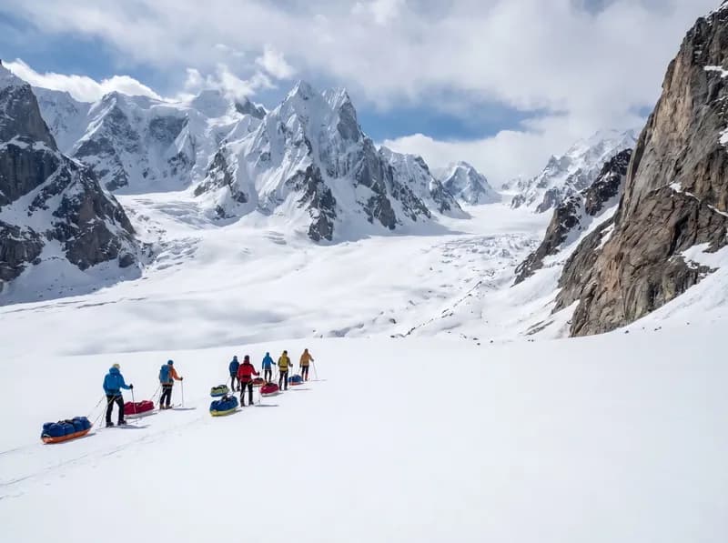
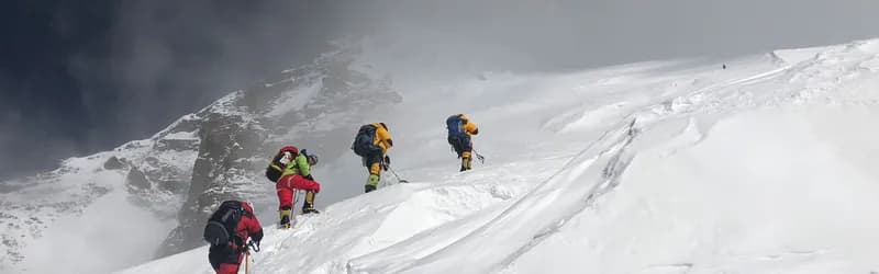
Spantik is often chosen by climbers stepping into the 7,000m range. It is more approachable than many Karakoram giants, but it is not a trekking summit. Teams still face glacier travel, cold camps, altitude, snow slopes, crevasses, and weather-dependent summit decisions.

Why Choose Spantik

  • A classic 7,000m Karakoram progression peak for fit climbers with alpine basics.
  • Beautiful approach through the Arandu side of the Shigar region and Chogolungma Glacier.
  • Southeast Ridge climbing with staged acclimatization and high camps.
  • A strong training objective before higher 7,000m or 8,000m expeditions.

Suitable For

Who This Trip Is For

This expedition is for fit mountaineers who have basic alpine climbing experience, crampon and ice-axe competence, glacier travel awareness, and the discipline to live in remote camps for several weeks.

It is suitable for climbers aiming for their first 7,000m summit when they already have strong mountain fitness and previous multi-day alpine or expedition experience.

Mountain History

Recent Records & Notable Events

New RouteVerified

First ascent of the Golden Pillar

Fowler and Saunders completed the first ascent of Spantik's immense northwest pillar in alpine style. The Golden Pillar became one of the most celebrated technical routes in the Karakoram.

Person or Team
Mick Fowler and Victor Saunders
Source: American Alpine Journal

Departures & Pricing

Plan Your Departure

Expedition Price

On request

Pricing depends on group size, route support, permits, and preferred departure window.

Listed Dates

Flex

Seats Open

Ask

Departure Dates

Plan a custom departure

Departure Window

Flexible

Flexible dates by request

Share your preferred arrival window and our team will confirm route timing, permits, and local crew availability.

Custom departure windows are confirmed with route timing, permits, and crew availability.

Itinerary

Day-by-Day Route Plan

Route Span

Days 1-30

Opening Stage

Day 1: Arrival in Islamabad

Final Stage

Day 30: Departure or Contingency

  1. Day01Arrival in IslamabadDaily route segment

    Meet the expedition representative, transfer to hotel, rest, and complete the first briefing.

    After immigration and baggage collection, a Namla Expeditions representative meets the group in the arrivals area and coordinates the hotel transfer. At check-in, the team confirms delayed baggage, emergency contacts, insurance details, dietary information already supplied, and the next morning’s schedule. The first full briefing introduces the Spantik Peak Expedition route, transport and weather contingencies, luggage separation, communications, and outstanding equipment questions. The remainder of the day is intentionally unstructured for rest, hydration, and recovery after international travel.

  2. Day02Fly to SkarduDaily route segment

    Take the weather-dependent mountain flight to Skardu, with road contingency planning if flights are cancelled.

    The operations team checks the latest airline and weather information before leaving the hotel and coordinates the airport transfer, tickets, and expedition baggage. Mountain flights remain weather-dependent; if a cancellation occurs, Namla Expeditions explains the available road contingency and revises later stages without compressing essential acclimatisation or safety time. After landing, the group collects all luggage before transferring to the hotel. A short arrival briefing covers meals, local timing, equipment access, and the next day’s plan.

  3. Day03Skardu Permits, Food, and Gear PreparationDaily route segment

    Finalize cargo, food, fuel, porter loads, route paperwork, communications, and personal equipment checks.

    This is a working preparation stage for the Spantik Peak Expedition, not simply a free day. The Namla Expeditions team reviews passport and permit details, insurance and emergency contacts, personal equipment, group loads, food, fuel, communications, medical kits, and transport timing. Participants lay out critical clothing and technical items so missing or unsuitable equipment can be identified before leaving town. Staff then separate road, porter, base-camp, and personal baggage, followed by an evening briefing on weather, wake-up time, and the next route segment.

  4. Day04Drive to AranduDaily route segment

    Travel by 4x4 toward Arandu, the main village gateway for the Chogolungma Glacier approach to Spantik.

    The group leaves after breakfast with personal bags and expedition loads secured in the assigned vehicles. Namla Expeditions drivers and field staff assess road, river, traffic, and weather conditions throughout the journey; stops are made for permits, meals, photography, and comfort only where parking is safe. Travel time can change after landslides or road works, so the day remains flexible. On arrival, rooms or tents are allocated, luggage is checked, and the guide gives a short briefing before dinner and rest.

  5. Day05Trek from Arandu to Chogo Brangsa AreaDaily route segment

    Begin the approach on foot through valley and glacier-side terrain, with local porters supporting expedition loads.

    After breakfast, the camp crew packs the shared equipment and the porter team receives the day’s allocated loads while participants carry their personal daypacks. The lead guide sets a sustainable pace over the terrain described above, with planned stops for water, food, layer changes, and regrouping before exposed, loose, or glaciated sections. On reaching camp, the team checks in with the guide, changes into dry layers, hydrates, and inspects feet and equipment. Dinner is followed by a weather, health, and route briefing for the next stage.

  6. Day06Trek Toward Bolocho CampDaily route segment

    Continue along the Chogolungma Glacier approach, adjusting camp location to trail and glacier conditions.

    After breakfast, the camp crew packs the shared equipment and the porter team receives the day’s allocated loads while participants carry their personal daypacks. The lead guide sets a sustainable pace over the terrain described above, with planned stops for water, food, layer changes, and regrouping before exposed, loose, or glaciated sections. On reaching camp, the team checks in with the guide, changes into dry layers, hydrates, and inspects feet and equipment. Dinner is followed by a weather, health, and route briefing for the next stage.

  7. Day07Reach Spantik Base CampDaily route segment

    Arrive at base camp below the mountain, establish sleeping tents, kitchen, dining tent, storage, and communications routines.

    The team first agrees a stable camp layout that separates sleeping, cooking, dining, storage, sanitation, communications, and waste areas. Namla Expeditions staff pitch and secure the shared tents, organise water and food routines, inventory arriving cargo, and test radios, satellite equipment, charging systems, and emergency resources included in the confirmed package. Participants inspect personal climbing equipment and identify anything damaged or missing. A detailed orientation then covers camp movement, hygiene, communications schedules, route access, weather updates, and emergency responsibilities.

  8. Day08Base Camp Setup and Skills ReviewDaily route segment

    Review glacier travel, fixed-line systems if required, crevasse rescue basics, altitude health, and team movement procedures.

    The team first agrees a stable camp layout that separates sleeping, cooking, dining, storage, sanitation, communications, and waste areas. Namla Expeditions staff pitch and secure the shared tents, organise water and food routines, inventory arriving cargo, and test radios, satellite equipment, charging systems, and emergency resources included in the confirmed package. Participants inspect personal climbing equipment and identify anything damaged or missing. A detailed orientation then covers camp movement, hygiene, communications schedules, route access, weather updates, and emergency responsibilities.

  9. Day09Acclimatization Around Base CampDaily route segment

    Take a local acclimatization walk and inspect the lower route while the team adjusts to base camp altitude.

    A rest or acclimatisation day is managed actively and may change with weather and team condition. Priorities are sleep, regular meals, hydration, foot care, drying clothing, charging essential devices, and repairing equipment. When appropriate, the guide leads a short, unhurried acclimatisation walk before returning to the same sleeping altitude. Each participant reports headache, nausea, unusual fatigue, sleep problems, or other concerns privately and promptly. Staff reorganise loads and supplies, and the evening briefing confirms whether the planned route can continue safely.

  10. Day10Carry to Camp 1 AreaDaily route segment

    Carry a first load toward the lower Southeast Ridge or Camp 1 area, then return to base camp for recovery.

    The expedition leader sets the day’s objective only after reviewing the forecast, snow, ice and rock conditions, team health, equipment, and progress from the previous rotation. The stage may be used for reconnaissance, a load carry, route preparation, camp establishment, acclimatisation, skills work, rest, or retreat; reaching a higher point is never automatic. Climbers check ropes, anchors, protection, stoves, radios, and personal systems before leaving. Agreed communication and turnaround times remain binding, and the team holds position or descends when conditions move outside the plan.

  11. Day11Rest at Base CampDaily route segment

    Recover, hydrate, check equipment, and reassess weather and snow conditions.

    A rest or acclimatisation day is managed actively and may change with weather and team condition. Priorities are sleep, regular meals, hydration, foot care, drying clothing, charging essential devices, and repairing equipment. When appropriate, the guide leads a short, unhurried acclimatisation walk before returning to the same sleeping altitude. Each participant reports headache, nausea, unusual fatigue, sleep problems, or other concerns privately and promptly. Staff reorganise loads and supplies, and the evening briefing confirms whether the planned route can continue safely.

  12. Day12Move to Camp 1Daily route segment

    Move to Camp 1 when the route is safe, carrying personal gear and shared loads as agreed.

    The expedition leader sets the day’s objective only after reviewing the forecast, snow, ice and rock conditions, team health, equipment, and progress from the previous rotation. The stage may be used for reconnaissance, a load carry, route preparation, camp establishment, acclimatisation, skills work, rest, or retreat; reaching a higher point is never automatic. Climbers check ropes, anchors, protection, stoves, radios, and personal systems before leaving. Agreed communication and turnaround times remain binding, and the team holds position or descends when conditions move outside the plan.

  13. Day13Carry Toward Camp 2 and ReturnDaily route segment

    Carry equipment higher on the ridge for acclimatization, then descend to Camp 1 or base camp depending on conditions.

    The expedition leader sets the day’s objective only after reviewing the forecast, snow, ice and rock conditions, team health, equipment, and progress from the previous rotation. The stage may be used for reconnaissance, a load carry, route preparation, camp establishment, acclimatisation, skills work, rest, or retreat; reaching a higher point is never automatic. Climbers check ropes, anchors, protection, stoves, radios, and personal systems before leaving. Agreed communication and turnaround times remain binding, and the team holds position or descends when conditions move outside the plan.

  14. Day14Move to Camp 2Daily route segment

    Establish or occupy Camp 2 and continue acclimatization on the Southeast Ridge.

    The expedition leader sets the day’s objective only after reviewing the forecast, snow, ice and rock conditions, team health, equipment, and progress from the previous rotation. The stage may be used for reconnaissance, a load carry, route preparation, camp establishment, acclimatisation, skills work, rest, or retreat; reaching a higher point is never automatic. Climbers check ropes, anchors, protection, stoves, radios, and personal systems before leaving. Agreed communication and turnaround times remain binding, and the team holds position or descends when conditions move outside the plan.

  15. Day15Camp 2 Acclimatization and DescentDaily route segment

    Climb higher if safe, then descend lower to recover before the summit cycle.

    A rest or acclimatisation day is managed actively and may change with weather and team condition. Priorities are sleep, regular meals, hydration, foot care, drying clothing, charging essential devices, and repairing equipment. When appropriate, the guide leads a short, unhurried acclimatisation walk before returning to the same sleeping altitude. Each participant reports headache, nausea, unusual fatigue, sleep problems, or other concerns privately and promptly. Staff reorganise loads and supplies, and the evening briefing confirms whether the planned route can continue safely.

  16. Day16Base Camp Rest and Summit PlanningDaily route segment

    Rest at base camp, review weather, repair gear, and plan the summit rotation.

    A summit attempt begins only after a final go-or-no-go review of weather, route condition, acclimatisation, team strength, equipment, and descent time. The group normally starts early, checks every harness, rope, light, layer, food, water, radio, and emergency item, then moves in the rope or climbing system agreed by the leader. Pace must remain sustainable and turnaround times apply even close to the objective. Reaching the summit is not guaranteed; the ascent is only half the day, and a controlled descent to secure shelter remains the priority.

  17. Day17Summit Rotation BeginsDaily route segment

    Move back up toward Camp 1 with the intention of continuing higher if conditions remain stable.

    A summit attempt begins only after a final go-or-no-go review of weather, route condition, acclimatisation, team strength, equipment, and descent time. The group normally starts early, checks every harness, rope, light, layer, food, water, radio, and emergency item, then moves in the rope or climbing system agreed by the leader. Pace must remain sustainable and turnaround times apply even close to the objective. Reaching the summit is not guaranteed; the ascent is only half the day, and a controlled descent to secure shelter remains the priority.

  18. Day18Camp 1 to Camp 2Daily route segment

    Continue along the ridge, managing altitude, snow condition, and team pace carefully.

    The expedition leader sets the day’s objective only after reviewing the forecast, snow, ice and rock conditions, team health, equipment, and progress from the previous rotation. The stage may be used for reconnaissance, a load carry, route preparation, camp establishment, acclimatisation, skills work, rest, or retreat; reaching a higher point is never automatic. Climbers check ropes, anchors, protection, stoves, radios, and personal systems before leaving. Agreed communication and turnaround times remain binding, and the team holds position or descends when conditions move outside the plan.

  19. Day19Camp 2 to Camp 3Daily route segment

    Move toward a high camp position for the summit attempt if weather and route conditions allow.

    The expedition leader sets the day’s objective only after reviewing the forecast, snow, ice and rock conditions, team health, equipment, and progress from the previous rotation. The stage may be used for reconnaissance, a load carry, route preparation, camp establishment, acclimatisation, skills work, rest, or retreat; reaching a higher point is never automatic. Climbers check ropes, anchors, protection, stoves, radios, and personal systems before leaving. Agreed communication and turnaround times remain binding, and the team holds position or descends when conditions move outside the plan.

  20. Day20Summit Attempt and DescentDaily route segment

    Attempt Spantik summit only in suitable conditions, then descend as low as safely possible the same day.

    A summit attempt begins only after a final go-or-no-go review of weather, route condition, acclimatisation, team strength, equipment, and descent time. The group normally starts early, checks every harness, rope, light, layer, food, water, radio, and emergency item, then moves in the rope or climbing system agreed by the leader. Pace must remain sustainable and turnaround times apply even close to the objective. Reaching the summit is not guaranteed; the ascent is only half the day, and a controlled descent to secure shelter remains the priority.

  21. Day21Descend to Base CampDaily route segment

    Return to base camp, rehydrate, rest, and confirm that all members and equipment are accounted for.

    After breakfast, the camp crew packs the shared equipment and the porter team receives the day’s allocated loads while participants carry their personal daypacks. The lead guide sets a sustainable pace over the terrain described above, with planned stops for water, food, layer changes, and regrouping before exposed, loose, or glaciated sections. On reaching camp, the team checks in with the guide, changes into dry layers, hydrates, and inspects feet and equipment. Dinner is followed by a weather, health, and route briefing for the next stage.

  22. Day22Reserve Summit or Weather DayDaily route segment

    A flexible day for delayed summit timing, route condition, weather, or recovery.

    A summit attempt begins only after a final go-or-no-go review of weather, route condition, acclimatisation, team strength, equipment, and descent time. The group normally starts early, checks every harness, rope, light, layer, food, water, radio, and emergency item, then moves in the rope or climbing system agreed by the leader. Pace must remain sustainable and turnaround times apply even close to the objective. Reaching the summit is not guaranteed; the ascent is only half the day, and a controlled descent to secure shelter remains the priority.

  23. Day23Reserve and Pack DayDaily route segment

    Use as a second reserve day or begin clearing base camp if the climb is complete.

    A rest or acclimatisation day is managed actively and may change with weather and team condition. Priorities are sleep, regular meals, hydration, foot care, drying clothing, charging essential devices, and repairing equipment. When appropriate, the guide leads a short, unhurried acclimatisation walk before returning to the same sleeping altitude. Each participant reports headache, nausea, unusual fatigue, sleep problems, or other concerns privately and promptly. Staff reorganise loads and supplies, and the evening briefing confirms whether the planned route can continue safely.

  24. Day24Clear Base CampDaily route segment

    Pack camp, prepare waste for return, organize porter loads, and begin the exit plan.

    Departure begins with a complete inventory of personal and group equipment. Tents and technical gear are dried where conditions allow, caches are accounted for, waste is separated for removal, and porter or vehicle loads are balanced within the agreed limits. Namla Expeditions staff inspect the site so equipment, rubbish, fuel, and food are not left behind. The guide also reviews the exit route, forecast, water, camp availability, and participant condition. Everyone keeps essential clothing, food, water, medication, and travel documents accessible rather than packing them into carried cargo.

  25. Day25Trek Toward BolochoDaily route segment

    Retrace the Chogolungma Glacier approach route toward lower camps.

    After breakfast, the camp crew packs the shared equipment and the porter team receives the day’s allocated loads while participants carry their personal daypacks. The lead guide sets a sustainable pace over the terrain described above, with planned stops for water, food, layer changes, and regrouping before exposed, loose, or glaciated sections. On reaching camp, the team checks in with the guide, changes into dry layers, hydrates, and inspects feet and equipment. Dinner is followed by a weather, health, and route briefing for the next stage.

  26. Day26Trek Toward Chogo BrangsaDaily route segment

    Continue down the approach with glacier and moraine travel managed according to conditions.

    After breakfast, the camp crew packs the shared equipment and the porter team receives the day’s allocated loads while participants carry their personal daypacks. The lead guide sets a sustainable pace over the terrain described above, with planned stops for water, food, layer changes, and regrouping before exposed, loose, or glaciated sections. On reaching camp, the team checks in with the guide, changes into dry layers, hydrates, and inspects feet and equipment. Dinner is followed by a weather, health, and route briefing for the next stage.

  27. Day27Return to AranduDaily route segment

    Complete the walk to Arandu and reconnect with road transport when available.

    After breakfast, the camp crew packs the shared equipment and the porter team receives the day’s allocated loads while participants carry their personal daypacks. The lead guide sets a sustainable pace over the terrain described above, with planned stops for water, food, layer changes, and regrouping before exposed, loose, or glaciated sections. On reaching camp, the team checks in with the guide, changes into dry layers, hydrates, and inspects feet and equipment. Dinner is followed by a weather, health, and route briefing for the next stage.

  28. Day28Drive to SkarduDaily route segment

    Travel back to Skardu by 4x4 and check into the hotel for rest and clean-up.

    The group leaves after breakfast with personal bags and expedition loads secured in the assigned vehicles. Namla Expeditions drivers and field staff assess road, river, traffic, and weather conditions throughout the journey; stops are made for permits, meals, photography, and comfort only where parking is safe. Travel time can change after landslides or road works, so the day remains flexible. On arrival, rooms or tents are allocated, luggage is checked, and the guide gives a short briefing before dinner and rest.

  29. Day29Fly to IslamabadDaily route segment

    Take the weather-dependent flight to Islamabad or use the road contingency if required.

    The operations team checks the latest airline and weather information before leaving the hotel and coordinates the airport transfer, tickets, and expedition baggage. Mountain flights remain weather-dependent; if a cancellation occurs, Namla Expeditions explains the available road contingency and revises later stages without compressing essential acclimatisation or safety time. After landing, the group collects all luggage before transferring to the hotel. A short arrival briefing covers meals, local timing, equipment access, and the next day’s plan.

  30. Day30Departure or ContingencyCompletion day

    Transfer for international departure or use as a buffer for road, weather, or flight delays.

    Namla Expeditions reconfirms the flight time and terminal before hotel checkout, then coordinates the airport transfer with enough time for security, baggage, and airline formalities. The operations team helps resolve any final luggage or document issue before the group enters the terminal. International tickets should retain sensible buffer after mountain travel because domestic flights and road journeys can be delayed. Services conclude after airport drop-off, unless additional accommodation or onward travel has been arranged in writing.

Field Planning

Prepare for the Journey

Fitness

Preparation & Fitness

Difficulty level: Hard. Spantik is less technical than many Karakoram peaks, but the altitude, glacier approach, long ridge, cold camps, and changing snow conditions make it a serious expedition.

  • Train for consecutive long days with a pack, high-altitude camp routines, snow climbing, and fixed-line movement if needed.
  • Bring tested boots, crampons, ice axe, harness, helmet, ascender, descender, warm sleeping bag, down clothing, goggles, and layered gloves.
  • Arrive ready for flexible summit timing; weather and snow stability decide the final plan.

Safety

Safety & Logistics

The team monitors glacier condition, crevasses, snow stability, weather windows, and altitude health throughout the approach and climb. Summit attempts are only made when the leader judges conditions suitable.

Namla Expeditions supports communications planning, group first aid, base camp systems, porter movement, and evacuation coordination. All climbers must carry insurance that covers mountaineering and evacuation at the expedition altitude.

Permits

Permits & Local Operations

Spantik is above 6,500 metres, so foreign climbers require the relevant Pakistan mountaineering permit process, royalty and environment fee handling, insurance documentation, route paperwork, and official clearance through a licensed operator. Namla Expeditions coordinates the paperwork and local logistics.

The approach normally uses Islamabad, Skardu, the road to Arandu, and the glacier route toward Spantik Base Camp. Porters, food, fuel, camp equipment, and waste return are organized from Skardu with support from local communities on the approach.

What's Covered

Inclusions & Exclusions

Included

  • Permit coordination for the confirmed peak, including government documentation, royalty and environment fee handling where applicable, route paperwork, and visa support letter assistance.
  • Airport transfers in Islamabad, domestic Islamabad-Skardu flights when operating, and the practical road alternative if mountain weather cancels flights.
  • Private 4x4 transport for the approach and exit route, including Skardu logistics, valley transfers, expedition cargo movement, and coordination with local communities.
  • Hotel accommodation in Islamabad and Skardu on the agreed sharing basis, plus expedition camping accommodation during the approach, base camp stay, and exit trek.
  • Full board meals on trek and at base camp, prepared by the expedition kitchen team with drinking-water management appropriate for remote Karakoram camps.
  • Licensed local guide support, cook, kitchen crew, porters for approach loads, base camp staff, and liaison officer or licensed guide support as required by the permit category.
  • Group camping equipment including dining tent, kitchen tent, toilet tent, sleeping tents, tables, chairs, kitchen equipment, fuel logistics, and base camp communications planning.
  • Group first-aid kit, base-camp emergency oxygen for altitude incidents, satellite communication planning, weather monitoring, and evacuation coordination support.

Not Included

  • International airfare to and from Pakistan, Pakistan visa fees, airport taxes, and any travel outside the confirmed expedition itinerary.
  • Personal travel, rescue, medical, and evacuation insurance. Expedition members must carry insurance that covers mountaineering, helicopter rescue, and the maximum altitude of the chosen climb.
  • Personal clothing and climbing equipment, including high-altitude boots, sleeping bag, down suit or down layers, crampons, harness, helmet, ascender, descender, ice axe, personal medical kit, and personal electronics.
  • Personal expenses such as snacks, soft drinks, bottled beverages, laundry, battery charging, showers where available, satellite phone use, internet, excess baggage, and tips for guides, cooks, porters, and drivers.
  • Extra hotel nights, meals, transport, porterage, or route changes caused by weather, road conditions, flight cancellation, illness, rescue, permit delay, or any other factor beyond the confirmed programme.
  • Personal high-altitude porter, personal climbing guide, supplemental oxygen, summit oxygen systems, or special summit support unless these services are clearly included in the final written quotation.

Common Questions

Frequently Asked Questions

Is Spantik a good first 7,000m peak?

Yes, for fit climbers with alpine basics and expedition experience, Spantik is a common progression into 7,000m climbing. It is still a serious mountaineering expedition.

Which route is used?

The standard plan follows the Arandu and Chogolungma Glacier approach and climbs the Southeast Ridge, subject to conditions.

Do I need a mountaineering permit?

Yes. Spantik is above 6,500m, so the Pakistan mountaineering permit process, fees, insurance documentation, and official procedures apply.

How many high camps are used?

Most teams use a staged camp system on the Southeast Ridge. Exact camp positions depend on snow, route condition, weather, and team strategy.

Are fixed dates published?

No fixed dates are added here. The expedition is enquiry-based so the team can confirm dates, permit timing, staffing, and final cost before booking.

From the Field Notes

From the same region

Related Journeys

Start Your Journey

Plan Spantik Peak Expedition with our local team

Reach our team directly. No booking system, no automated responses — a direct line to the people who run these routes.

Price on request